Sunday, September 30, 2012

Peter Grubb and Loney Lake


From Selma:


Wednesday 5 women headed up the hill to hike the trail to Peter Grubb Hut. We did not get very far before we were stopped in controlled traffic on Highway 20.
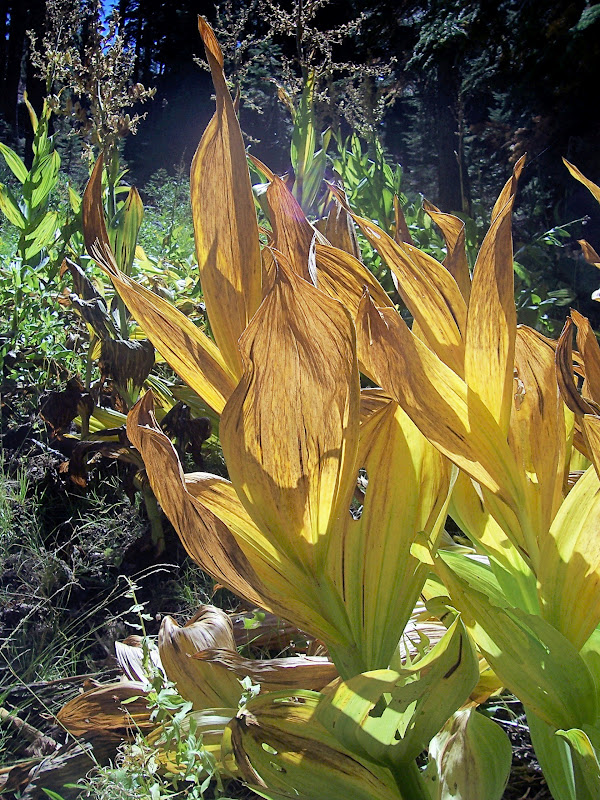
The crews were busy on each side of the Highway clearing brush and trees. This happened multiple times. As a result we did not reach the trail head to begin hiking until 10:45 a.m. Undaunted we started out enjoying a beautiful Fall day. The air was clear and fresh, blue skies and the signs of Fall in the views. and foliage. Not many other hikers. Priscilla brought her book to identify trees and she and Karen gave Barbara, Maureen,and myself a lesson while we had our lunch. After a relaxing we headed back. Shortly after leaving Castle Pass we turned left and followed the loop trail back through the trees to the parking lot. Fortunately on the return trip we were only stopped once on Highway 20. We all agreed that it had been a lovely day.


From Maureen: (her pix too!)
hi hikers
the temperature was so pleasant.
we enjoyed lunch at the peter grubb hut area.
all and all we had such a good time together.
oh! and to top it off we met a poodle named dino
named after no other than dean martin.
take care,


Three Guys, Two Lakes, One Tough Hike


It turned out to be a guys day out for the 8:00 hikers on Wednesday.  Three of us decided to try a cross country hike to Loney Lake, and then on to Sanford Lake.  We started at the locked gate below Blue Lake, having decided to drive the very rough road up from our regular parking place.  We got to the petroglyphs area in about an hour, then continued another half mile or so on the trail to an area below our goal, just before where the trail crosses the stream that flows from the lake.  Loney Lake is not reached by trail, but we headed in an approximate straight line towards the lake, using our GPS as a guide.  We were about a mile from the lake, and initially the going was pretty easy in open granite country, but closer to the lake as we reached the outlet stream, the country became quite jumbled with granite cliffs and deep ravines.   There was a surprising amount of water in the stream, and beautiful pools and waterfalls.  Plenty of picture postcard views.  There is a lovely small grassy tarn below the main lake affording more photo opportunities.  Loney Lake itself is beautiful with cataracts crashing down the steep sides on the cliffs above the opposite shore from where we stopped to each lunch.  But soon we were surveying the very steep slopes which separated the lake from Sanford Lake, which we knew was above us on our left.  Once again the GPS was our guide, showing that we were only ¾ of a mile away.  But this was the toughest part of the hike.  Very steep going, slippery gravelly footing, lots of all-fours scrambling.  Frank did a great job of picking our route and we followed him as he scouted ahead.  The last part was the most challenging, heading straight up a chute, but plenty of handholds and footholds made it possible.  And we emerged at the top to find Sanford Lake right at our feet.  It’s a hanging lake, perched in a beautiful bowl with a very narrow rim separating it from the steep cliff that plunges down to Loney Lake.  This is quite amazing country.  The rest of the hike was on trail, first up to the Grouse Ridge campground, then down down down back to the petroglyphs area and back to the car.  We were happy we had driven up that last bit of rough road, as we were definitely ready to sit and ride.  We hiked about 10 miles and climbed a total of about 2200 feet.

Next week: perhaps Devil's Peak from the West side.


Loney Lake


Pool below Loney
Loney Lake from route to Sanford Lake


Water Source, Loney Lake
Sanford Lake


Sanford Lake from Rim
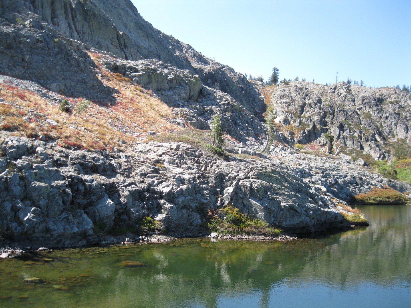
Sanford Lake


John and Peter climb UP


Thursday, September 20, 2012

Devil's Peak: first attempt

Just understand - we spent a lot of time looking for the trail up Devil's Peak from the East side.  Not there.  Much time was spent in the search of the trail that indeed DID show up on both our GPS's and the map.  Speaking of GPS, John's fell out of his clip and some time was spent looking for it in the steep bushwhacking area.  Miraculously he found the exact spot of it's separation and was thus reunited.

So five of us drove through the Serene Lakes subdivision, past Royal Gorge Summit Station, and down a fairly good dirt road.  It wended it's way past Kidd Lake and such - probably on the access road all the way to the Devil's Outlook Warming Hut.  We went down to Cloud's Rest and more steeply down to the land bridge between the Cascade Lakes.  After that the beautiful trail went by lake after lake - one with the name of Long Lake.  We had views of the Sierra Crest, beautiful granite, and Devil's Peak right next to us.  Then we plunged further downhill and through old growth cedar forests with a lighter green understory of what I think is Thimbleberry.  It was remindful of a coastal hike. 

And so we gave up trying to locate the fabled connector around the bottom of Devil's Peak and hiked back up the beautiful trail so we could enjoy it once again.  We had hiked over 9 miles with over 1000 foot elevation gain.  Perhaps in two weeks we will give it another try by hiking down the west side of Devil's Peak.  We may attempt entering the area from further down the freeway near Kingvale. 

Two ideas for next week  are Loney Lake, from Blue Lake; and Buzzard's Roost near Sand Ridge Lake.

The following site will provide the lowdown about saving the area for recreational use.

http://www.tdlandtrust.org/news


Devil's Peak

picture and map from Frank


Friday, September 14, 2012

Sterling Lake/MossyPond

Seven people, six hikers in two high-clearance pick-ups went up the Lake Sterling Road to meander among the 13 lakes that make up the area north east of Forcyce Lake.  Trails are poorly marked which meant the relatively easy 7 mile hike required  numerous boulder climbs and bushwhacking through lots of brush.  Although Frank didn't hike due to a previous injury, he stuck his GPS in Ellen's pack to record the trace.  As you can see, it looks like we were drunkenly stumbling hither and thither between the stunning lakes and views.  After lunch we left the packs (and the GPS) and hiked up the granite behind the lake for further views.  It was beautiful rock hiking over smooth granite with rock inclusions - kind of like a smooth climbing wall.
This was one of the prettiest hikes we've taken this summer -- lake after lake, each distinct and beautiful in its own way.  We ranked the lakes and decided that lake 5 was the winner, but any one of them would do in a pinch!  Definitely a hike we hope to repeat next year.  Oh, and the drive there wasn't as bad as we had thought -- about equal to the road to Grouse Ridge.  But high clearance vehicles make it easier, for sure.
 
Next week we're thinking of doing Long Lake, out of Soda Springs.  It's a short hike, but provides access to Devil's Peak, which we most likely will attempt to climb.  We'll start at 8:00.
Sterling Lake
 

Jeep Stuck in Sterling Lake (not one of ours)


Above pictures of Sterling Lake from Frank.

Back of Old Man Mountain


Lake 5

Lake 5.5


Saying "good-bye" to Lake 12
 

Mossy Pond, lunch spot


A polar bear visits Mossy Pond

Maureen wrote that the other group had a great time at Barker Pass in the East Sierra


.


Thursday, September 6, 2012

Beyers Lakes

Beyers Lake Lunch Spot
 
Old Man Mountain
 
Curious what was on the other side of the Black Buttes,  6 members of the 8 o'clock group headed up into Blue Lake for the advertised "relatively level 12 miles RT hike to Beyers Lakes".    When we got to the destination it was already 1:45 and we found that we had not gone 6 miles, but 7.  And it had not been level.  The hike had been gorgeous with it's many meadows and huge outcroppings of granite.  We had run across only a single hiker, a gun-totin' camouflager, who hadn't made it to Beyers Lake.  So we had the back-country to ourselves.  The clouds were building and although we expected rain, we managed to only get the cooling effect of same.  That is lucky because of the trail were quite rough and could have been much more difficult if wet. 

Beyers Lakes are beautiful and would make a great backpacking trip.  We all wished we could stay longer and bask in the beauty but after a belated lunch we figured we had too many miles before us to chance the wait.  Our muscles were aching and toes were burning but we made it back with only a couple of tumbles (mine) of unserious consequence.


Lunch at Beyers Lake
 

Next week we hope to go the long off-road vehicle trip into Sterling Lake with off-trail meandering among various lakes back to Mossy Pond. 
 Above pictures from Frank.


Maureen wrote: Turns out the other group was right below at Forcyce Creek...here are her pictures:


Followers

Blog Archive