 |
| fingers courtesy of Frank |

Seven of us went up to explore Royal Gorge further on the opposite end from Devil's Peak. We passed Ice Lakes Lodge and found ourselves on a well-maintained dirt Forest Service road. Not knowing where to start the hike, we explored some areas by car, enjoying the long view into the deep gorge of the American River. Anderson Peak and Tinker's Knob were before us, as were many other unidentified peaks. A pick up and a rented U-Haul van passed us so we thought that it would be fun to explore that road further at some other time. We started the hike on an unnamed jeep road that headed steeply up the back of the ridge I wanted to hike on. Sometimes bush-whacking, we kept wending our way to the ridge and were rewarded with incredible views. Unfortunately there was heavy smoke to our northeast, beyond Castle Peak, which we hoped was a controlled burn.
We decided to eat lunch on the ridge near a dramatic volcanic extrusion. The rocks were weathered much in the same fashion as the rocks on the trail between Castle and Basin Peaks. The forms are sculptural, resembling sentinels.
 |
| Devil's Peak |
We went on towards the Sugar Bowl peaks between us and the PCT. We only made it up to the nearest one, called Crow's Nest, a steep climb in snow that offered incredible views all the way up. At the top there was a rock scramble to the very top and much to our amazement we were right on top of a brand new looking ski lift. Mt. Disney, Mt. Lincoln and Mt. Judah were in front of us, giving us ideas for another hike.
This was another exciting exploration hike in a summer full of them. And it's mid November, for heavens sake! If we hadn't spent so much time exploring the road at the beginning, we would have had more time for getting up Disney as well. Next week?
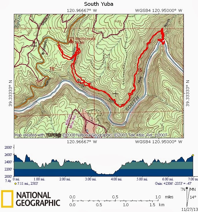
We hiked about 7.5 miles with an elevation gain of 1826 feet, highest peak being 7849.
 |
| Blue trace is today's hike |

 |
| From the top of The Crow's Nest |
 E
E


 Seven of us went up to explore Royal Gorge further on the opposite end from Devil's Peak. We passed Ice Lakes Lodge and found ourselves on a well-maintained dirt Forest Service road. Not knowing where to start the hike, we explored some areas by car, enjoying the long view into the deep gorge of the American River. Anderson Peak and Tinker's Knob were before us, as were many other unidentified peaks. A pick up and a rented U-Haul van passed us so we thought that it would be fun to explore that road further at some other time. We started the hike on an unnamed jeep road that headed steeply up the back of the ridge I wanted to hike on. Sometimes bush-whacking, we kept wending our way to the ridge and were rewarded with incredible views. Unfortunately there was heavy smoke to our northeast, beyond Castle Peak, which we hoped was a controlled burn.


