Thursday, July 7, 2011

FERC relicensing tour - day 2

Beware!  This was a day of learning a new vocabulary: forebays, afterbays, penstocks, reverse siphons, and FERC (Federal Energy Regulatory Commission).

On Thursday, four of us, Peter and his wife, Jo, John, and I drove and hiked (a little bit) with about 25 others as part of the public input phase of the 50-year relicensing process.  We toured the Spaulding/Drum watershed beginning with the Drum Forebay, which receives it's water from Lake Spaulding via the 9 mile Drum Canal.  You have seen this canal from route 20 - it looks like the water is going uphill.  We looked down on the penstocks feeding Drum power houses #1 & #2 and then drove to those powerhouses.  This required a long drive on a single lane paved road (mostly) and would make a great hike for us during colder months due to the beautiful views down to the Bear River and across to the Dutch Flat flume with it's reverse siphon.  Drum Power house #1 was built in 1913 and houses 4 large pelton wheels.  Next to it is a more modern pelton wheel powerhouse built in 1965. 

The Bear then goes to the Drum Afterbay which has three outlets: one to the NID/Dutch Flat Flume, another to keep the river flowing,  and the third to a PG&E Dutch Flat powerhouse.  The NID flume feeds a second powerhouse on the Dutch Flat Afterbay.  From here some of the water feeds the Chicago Park Flume which powers the Chicago Park power house.  That emptied into the Bear River and then Rollins Lake.  The silt build-up from mining was evident in the mounds of gravel of the river. 

We walked across Rollins Lake Dam getting a good view of the spilling spillway (later than normal), and the beginning of the Bear River and the PG&E canal that feed Placer County (this was the canal which suffered a blowout in April). 


So I told you the direction of the water but actually we took a break in the middle, heading to the NID and private lakeside campgrounds and picnic tables in Rollins Lake behind Chicago Park.  People were swimming and launching boats, enjoying the water on a hot day.  Most of the people in our group were from various federal and state agencies and from consulting engineering companies.   Many people are employed thanks to the relicensing requirements!

Lower Rock Lake

Ten of us went to Loney Meadows
and ended up at Lower Rock Lake for lunch.
we crossed lots and lots of snow as we got closer to the lake.
we all had a delightful hike-temperature wise. all from Maureen


Friday, July 1, 2011

Lang's Crossing Geology Lesson


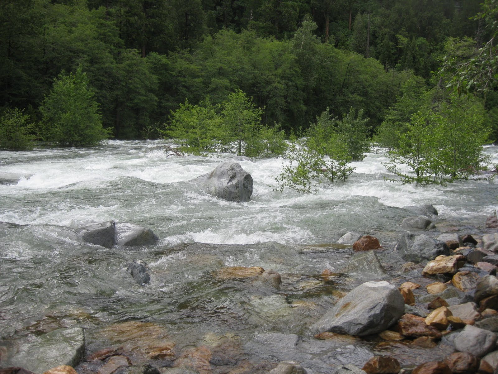
Our group of 7 headed off up the trail from the Yuba under iffy skies in fairly cool weather.  The river was running wildly white over trees and rocks below us.  The wildflowers were a delightful mix of what we had seen plus some high altitude penstemon, pink pussy paws, and a deep red paintbrush.  Mariposa Lily, Monkey Flowers, and Fairy Lanterns also grew among the rocks.  Perhaps the most spectacular was the deep red of the Canyon Dudleya clumps in the rock crevices.  The trail wends it's way along the south face on the way to Fuller Lake with views of the river and mountains.  We were thankful for the cool weather as it could be a hot hike.  About 2 miles up, the trail came to a usually small creek that was too wild to cross.  We returned to Lang's under threatenbing skies, taking a small detour to see a lovely area Clarence knew about.


The group decided to take another hike, further up the road down an overgrown powerline trail that would afford some more views of the wild Yuba.  We put on our raincoats, expecting it at any time to chance sitting on a rocky overlook down the trail.  As we commenced to eat lunch, the sky cleared, we took off our extra clothing, and basked in warm sunlight as we watched Signal Peak and the Monument Range emerge snow-covered from their clouds while the Yuba raged below. 

Dave led this part of the hike continuing on his geology talk he had started on the previous section.  We had seen some unusual rocks and were to see a lot more.  Since he should write this part I will leave it to him to teach you but needless to say, we saw a lot of beautiful and different rocks formed 4 hundred million years ago.  They were folded and extruded and generally colored lovely reds and pinks if they contained iron oxide, often embedded with various types of crystals.  He lead us up some steep rocks, as we continued west over talus and boulders to a view pretty much directly across from our Plantation hike views.  The river below had formed an island and the falls above it was not visible except for the spray.  Below the island was called "Lower Emerald Pool" but was a white foamy mass like the rest.
Which leads me to this warning:  Do not take your dogs near the Yuba or it's feeding creeks!!  
Sadly, Akiko lost her beloved Puka in Humbug Creek a couple of weeks ago.  Puka was happily swimming around as Goldens do when the current got ahold of her and she became helpless.  They have yet to find her.


Next week will be a continuation of exploring how high we can get, going up to Carr/Feely(?) and hiking around to Loney Meadow.  So far, no snow.  I wish we could be there but it looks doubtful - anyone for hiking Thursday? 

Pictures  by Clarence and Elly.


Thursday, June 23, 2011

Zeibright Mine/Bear Valley


On a very hot Wednesday, twenty two of us (I think) headed down the the level dusty trail to Zeibright Mine.  The only problem was that the return trip wasn't as level we had thought.  Phew.  Gotta get to the next piece of shade.  The Bear River was appropriately roaring as it plunged along beside us. 

Zeibright mine was named for Fred Zeitler, who started it in 1900, and Wm Englebright (and others)who bought it 3 years later.  The mine was variously owned by individuals and the State, sometimes producing, sometimes fallow.  Ore cars went down the vertical shaft, raising the cars to the upper area where they the quartz was crushed in the stamp mill.  Some of us explored the head frame and it's debris strewn around in the weeds.  A loud frog croaked from down in the mine shaft and a spring dripped quietly into standing water. 

The present owners run the 17 acres as a non-profit camp for large non-profit groups.  They are quite welcoming, allowing us to use their bathroom and poke around as long as there are no groups using it.  There is a marked degree drop in temperature at the mouth of the tunnel, which our group thorougly enjoyed.  If you go there during the snowy times, you might well get warmed as the temperature coming out of the tunnel is rather constant.  There is a vertical shaft near the horizontal tunnel that causes the breeze.  There must be some use for this but I didn't hear it.

Picture from top to bottom: Frank, Clarence, and Maureen.  Next week will do Pioneer Trail from Lang's Crossing, Bowman Rd.  The week AFTER we will start the summer start time: 8:30.  July 30 is potluck party - RSVP.

Thursday, June 16, 2011

Hallelujah Trail


Fourteen of us went up Highway 20 to the Skillman area where we could take the trail west towards White Cloud.  Unfortunately the weather was hot and muggy - I can't believe I'm complaining about this but...- but we hoofed it through the forest admiring the many dogwoods.  While we watched our footing, Maureen got some art-y shots of minutiae.

I researched Solomon's Seal and came up with some confusing information. I find no evidence that we have Solomon's Seal (Polygonatum).  We do have False Solomon's Seal (Smilacina) - with it's flower on the terminal end.  The plants I thought were Solomon's seal were probably Hooker's Fair Bells.  All these plants are members of the Lily Family.  To confuse things there is also Star Flower or slim False Solomon's Seal.

We also saw pine drops, purple trillium (I think), larkspur, Madia (yellow flower with flower petals in groups of 3 - aster family), and lots of bleeding hearts.  Add Labrador Tea bush (I think).


Thursday, June 9, 2011

Followers

Blog Archive