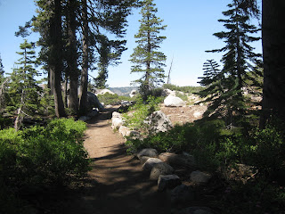


Sixteen overheated hikers tried to block out freeway noise as we struggled up the steep trail that begins at Big Bend outhouse. Akiko, Becky, Clarence and his grandson Matthew, Jo, Grace, both Marilyns, Stan, Jeff, his friend Dawn, Tiana, Maureen, Tammy, John and Elly hiked up to the middle lake for lunch. Tiana picked up a splinter in her foot after she and Elly went swimming. Removal became a major project as Elly, Maureen, and finally Akiko successfully removed the stubborn offender. Some of us dawdled as we descended from shade to shade, let our knees rest, took pictures, and drank yet more water.
Next week is the Mt. Juno challenge (oops - Mr. Lola is correct - as John commented below) for those who want to meet at 8 and Summit for all others meeting at 8:30.
Next week is Mt. Lola, NOT Mt. Juno. This is for the 8 AM hikers.
ReplyDeleteFor those choosing the extended hike on Wednesday, the following is taken from the internet and is interesting.
ReplyDelete"Mt. Lola is the highest Sierra peak north of Interstate 80, the high point of Nevada County, and the northernmost point from which the waters of Lake Tahoe can be seen. Not far from the county line, a subsidiary bump along its north ridge called Lola North is the highpoint of Sierra County - thus the two are often combined by county highpointers in a single outing.
Formed from an ancient volcano, Mt. Lola is a surprisingly unassuming mountain, even for the northern Sierra. Most of its sides are rounded and easily climbed, and it is outflanked by the more rugged features of its neighbors, Castle Peak to the south and Sierra Buttes to the northwest. But for a nondescript mountain it offers possibly the finest views of the northern Sierra region from its northern edge where the range melds into the Cascade Range (Mt. Lassen can be seen from the summit on a clear day) south to the Desolation Wilderness on the southwest edge of Lake Tahoe.
The Pacific Crest Trail passes beneath the peak to the west, and most of the land surrounding Mt. Lola including the peak lie within the Tahoe National Forest. To the north the Little Truckee River has carved out a wide canyon running east-west, and the beautiful Perazzo Meadows lie at the base of the peak through which the river meanders. The land here is a checkerboard of private and public lands, a result of settlement incentives handed out in the 1800s.
The peak is not a difficult climb, requiring only 10mi RT and 2600ft of gain during the summer, all of it on trail. Consequently it is climbed frequently."
Here is how we will drive to the Mt. Lola trailhead:
ReplyDelete(taken from the internet) "From I80 east of Truckee, take SR89 north for 14.5 miles, turning left on NF07, a decent paved road maintained by the forest service that heads west following the Little Truckee River on its north side.
After 1.6mi on FS07, turn left (south) at a stop sign onto a graded gravel/dirt road, crossing the Little Truckee River on a one lane bridge. A half mile after the bridge turn right (west) at a 4-way junction and stay on this road. Ignore several spur roads, cross Deans Crick on a bridge, pass more spur roads, drive by some private homes, and 4.0mi after leaving the paved FS07 you should find a parking lot on the left side with a sign marked Mt. Lola Trail.