Wednesday, December 15, 2010

Gray Lodge


Pictures by Clarence.


Lucky us! It was a Wednesday and a bright, sunny day for a walk at Gray Lodge. Seven of us joined Karen (yes, Karen! and she's looking good) down in the valley hinterlands looking for BIRDS. Tiana wanted the money taker to assure us that we would, in fact, see birds. And birds we saw - tundra swans and snow geese, red-tailed hawks, and ducks galore.
The wheeling flocks made wonderful swishing/chickenyard calls as they would tentatively decide to take to the air in great hords of flapping and group wheeling, take a few turns and settle down again to noisily floating around in groups of like species. Karen brought some extra persimmons and delicious persimmon bars for all at lunch. It was great to see her and all agreed that in spite of the low foot mileage, we had a lovely day.
If you go looking for Gray Lodge, follow the green line from Route 70 in Gridley. We continued to look for the flock of elusive ibis. Instead, we headed home, checking out the piles of free-for- the-taking rice hulls and happy that we had been properly warned by an on-coming truck of a speed trap up ahead.

Wednesday, December 8, 2010

Cascade Ditch

Well, he had made lunch so rain or shine, we were going to hike. Not surprisingly we were the only ones at Sutton Way so we decided to hike up on Banner. After winning a disagreement on proprietry, I knocked on Akiko's door. "Sure - I love hiking in the rain." So off we went on a trail in the green space around her development and then on to the Cascade Ditch trail. We crossed Red Dog at the end and kept going, rain be damned. Even shared our first lunch (the one John had packed) and ate while walking in the wet. Altogether we probably hiked 8-9 miles, remarking on the Banner Mountain damage from the Big Storm all the while. Amazing amount of torn up trees both on and off the trail - they have been cleared off the trail, though. There was some old snow and ice in the usual parts which slowed us up a tad. We hauled our wet, bedraggled selves into Akiko's garage and went into her house for a lovely bowl of soup and cookies...and what was left of John's packed lunch.

Wednesday, December 1, 2010

Fairy Falls


Top 6 pix from Clarence.


Having helped Karen gather and crush her walnut crop, Barbara brought us bags of walnuts. Even Laurie showed up. Kudos to Karen and Barbara. Next year we should schedule a fun work day helping with the harvest.


But with sun on our minds, we left Barbara to her dental extraction appointment (lucky lady) and headed down to Spenceville to do the first of our winter walks there. Lovely weather, lots of water...what more could we ask for? Two large birds of prey called and soared over us a few times. We thought they were eagles or a redtailed hawk but after looking at a few bird books, I think they were harriers. After admiring the falls, we headed up into the (former?) pastures shimmied under barbed wire fences and finally settled on a hilltop with a great view of the valley, including the Sutter Buttes in the haze. We relaxed and baked in the sun. After walking down the hill, Clarence and John looked at their GPS's and took a turn away from the cars to extend the hike. We did a large circle as part of a figure 8, ending at the main dirt road. We had hiked somewhat over 7.5 miles.


The recent storm led to some exciting stories: Many of us lost power for an extended period of time, turning our houses cold and dark, and eliminating our water supply. We also lost many broadleaf trees. Akiko lost power for 6 days and she and Selma still don't have phone service.


Next week will be the Gray Lodge bird sanctuary. It is a short hike but lots of birds in the flooded rice fields. We hope that Karen will be able to join us.

Wednesday, November 17, 2010

Hallelujah Trail


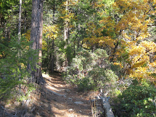
Fourteen of us gathered to try the Hallelujah trail off 20 from Skillman Camp. We were treated to a lovely, woodsy trail, not a lot of elevation gain/loss, and miles of hiking among big trees with colorful oak and dogwood interspersed. Highway 20 was intermittently heard for the duration of the hike. At a large clearing, Clarence led the bulk of the group on the return trip to the cars, while 5 of us went on the Pioneer Trail to the overlook of Scott's Flat/Banner Mtn. and beyond below White Cloud. Pioneer Trail skirts the hillside in and out, along and in ditches with lovely views out on occasion. We ate lunch on a sunny slope before heading back to Skillman. The trail had a couple of mountain bikers and a couple of hikers but was otherwise our own. We returned home by 4 PM, having hiked about 10(+) miles.


Next week is Thanksgiving so there will be a local hike, weather permitting.

Thursday, November 11, 2010

Rice's Crossing


Clarence took above pictures and map.


Eight hikers defied the recently receding rain to hike the planned Rice's Crossing. Barbara requested to hike it clockwise from the parking lot from Buttermilk Trail. It was a lovely autumn day with plenty of color and the typical weather when you put on more clothes and then shed them once again. Lunch was on the rocks around the crossing, making the hike an easy 6 miles with some elevation gain (and loss).

Afterwards Barbara gave us all a tour of the Lake Wildwood community, as we had never seen it. Quite charming on such a beautiful day - and her house was stunning - and clean. her dog well behaved. How does she do it?

John and Clarence are previewing a hike off Route 20 for possible fall color on next week's hike.

Thursday, November 4, 2010

PCT to Benson/Pioneer Trail along 20


Clarence's pictures of PT and Frank's 2 maps.


Once again the high Sierra beckoned us so we ended up dividing into 2 groups of 8.

Closer group (from Clarence):
We moved the starting time back to 9 AM for the winter months. Our group hiked the new section of the Pioneer trail going toward Bear Valley and we were able to start hiking at 9:30.. Weather was perfect (again). Cool to start, but soon we were sweating. This section of the trail has a beautiful tall forest area. The path was soft and covered with pine needles. I figured it would be 4 miles out to an overlook of Bear Valley and a good place for lunch, but I was wrong! The overlook was always "just ahead"! After nearly 5 miles one way (and after 12 o'clock), I suggested it was lunch time. Everyone agreed! I'm still looking for that overlook.
After lunch we returned back to the cars and my GPS said we had done 9.75 miles.
Next week suggestions are for Malakoff Rim trial and Rice Crossing (or maybe a variation suggested by Barbara).
I will send an invite to view other pictures on Snapfish. Clarence

The high group did the PCT from Donner Ski School, near Donner Pass on old Route 40. We picked up a Truckee hiker, Dave, who hiked the entire way with us, even gallantly carrying Tiana's pack to relieve her hurting feet (new boots - will she exchange them AGAIN at REI??) John and I did this trail to Benson Hut Oct 6 of last year in 3 in. of snow - this year there was only a scattering of snow/mud. Global warming? Out to the hut is about 5.6 miles, making for a hefty hike. We would like to do the hike from Squaw to Benson next year. Certainly Frank and Ellen are interested and they will probably not be here next week due to Frank's eye surgery. The ride through the Sierra to the hike start was gorgeous with aspens (along the Yuba), oaks, and maples. Wednesday's trail alternated between exposed ridge and fir forest. The snow-covered peaks, gorges, and rock displays make this hike well worth it, even if you don't go all the way. We did, though - and ate lunch only slightly late at the hut. The hut is as lovely as the Peter Grubb hut but the bathroom ONLY has an upstairs...which means the determined among us had to climb a vertical ladder and manage a door at the top from that position. Only Ellen, I think, dared try.

We would like to keep hiking the high country as long as we are able - maybe Frog Lake overlook next week? We would park at the Boreal exit where the trail takes off near outhouses.
We just got word from Clarence that Priscilla's ex-huband, Don, passed away on Tuesday. We are thinking about you, Priscilla. And on a brighter note: Jan is doing well and is recovering from her surgery at home now.

Saturday, October 30, 2010

Humbug Creek


From Clarence: (Please note time change):
John had the idea to shuttle with this hike. This way we could walk one way, DOWN along Humbug Creek and along the Yuba to finish.
It was a cold, but beautiful start though the forest. We then found the nice trail was not always nice! Wash outs, trees down and dangerous small bridges in need of replacing. Sometimes the trail disappeared. Despite that, the scenery was great and we didn't have to retreat.
In the middle of no-where we found perfect picnic tables and a sunny spot for lunch. The rest of the hike was very warm and we had to stow the jackets and gloves. We successfully made the shuttled loop.
We decided next week we will start leaving at 9:00 AM . Spread the word to the rest of the group. There is still the effort to find nice Fall colors and ideas for a hike some where along Hwy 20.
I will send an invite to see more pictures with Snapfish. CLARENCE

Thursday, October 21, 2010

Fall Creek Mountain


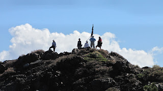
Nine hikers who enjoy a challenge and unknown trails (or lack of them) gleefully headed up from Carr/Feeley partway to Delaney Lake and then headed off the trail into the brush towards Fall Creek Mountain. We had no idea what we were doing so we went up and down, laughing at the silliness of creeping through the brush on deer trails. "Oh, let's look at that ridge!" We were quite taken with the precipitously balanced glacial erractics that looked like a strong wind would blow them over the cliff.When Hidden Lake appeared, we looked UP and saw our destination: rocky cliffs. Once again we used all fours and headed up the moutain on the least brushy route we could muster until we arrived at the top and the coveted prize: the Staff of Underwear. Sadly, we all had forgotten our extra undies and had nothing to contribute but we were happy to sit under others' castoffs to enjoy yet another stupendous view and lunch. Visible, were at least 5 lakes at a time, not to mention the outhouse next to the Quail Ridge Lookout which some of us wished were a bit closer.

Towards the beginning of the steep slide down the other side, John managed to misjudge a good place to change his GPS battery. Suddenly, between his legs, out buzzed a swarm of yellow jackets, quite happy to sting anyone in sight. They got both John, who was moving fast, but not fast enough, and Maureen, right under her Michael Jackson glove. Both sustained sufficient venom to deal with serious swelling to their hands. Even today (Thursday), John's hand resembles a rubber glove blown up like a balloon. He has a doctor appointment tomorrow so that we may each carry an epipen. After the descent towards a back road to Lindsay Lake, we found our way down below Carr/Feeley parking and returned to our cars. Was 4 miles enough of a hike? I guess all the rock climbing/bushwhacking and sliding down exhausted about everyone so that the enthusiasm for another hike didn't seem to be evident.

After running into the other group (of about the same size as ours) we had to satisfy Frank's curiosity about what the Emigrant Trail did when it crossed Bowman Lakes Road. Where did they actually lower those wagons down? Where did it hit Bear Valley? S0 we did a bit more exploring at those sites. The other group hiked about 6 miles round trip to Fordyce Falls...and seemed to have enjoyed it. I'm happy to post a report if anyone from that group wants to write one.


I have no idea what is supposed to happen next week. A number of us will not be able to hike that week. Anyone want to comment on the other hike? About next week?


Thursday, October 14, 2010

warmer higher/colder lower


3 photos from Clarence


Fall Creek Mountain from Frank - next week?

Carence:
An interesting day on the North Fork of the Yuba. We started our hike in the cold! Surprisingly cold! We saw frost and ice on the river and everyone broke out their jackets and gloves. There was no sun in the canyon for quite a while.
My GPS would not "acquire" satellites in the narrow canyon so I turned it off until lunch time.
Eight of us set a good pace through the miners campsite and on to the Cherokee Creek footbridge, where we saw the first of the swarm of Lady bugs. Evidently they like this area for winter hibernation. They were thick. We continued the rest of the way to our lunch spot at the junction of the Yuba river and Canyon Creek. There we saw even more Lady Bugs. They were crawling and flying at our lunch spot. Good thing these are not the vicious type!!
The dry Autumn leaves completely covered the trail at times. This made it slippery and very hazardous at times when the trail was steep. Instead of sliding, Priscilla had to sit down and "scoot" down the path at one point. Of course this cleaned the leaves off for the rest of us following! Thanks Priscilla !
In the afternoon the temperature was up and we were sweating by the time we finished our 8 mile RT to the cars.
Yes, we did stop in NSJ for the bargain priced ice cream cones. We had a few strong willed people that resisted.
For next week we should look for a hike with Fall colors. Dogwood and Maple trees. Ideas were for: Omega road, Rock Creek area, or Lang Crossing to Spaulding . . . .

Elly:
With Jim as our leader our group of 6 hiked 9 miles clockwise from the Carr/Feeley parking up around Island Lake, bushwacking through the Crooked Lakes, wandering through a forest of down and logged trees, finally coming to the Grouse Ridge Trail. After about a mile, we took another right just short of Grouse Ridge to head back past Milk, Round, Long, Island, Delaney, Carr and Feeley Lakes. We paid our respects to each of the lakes, wondering what with all the Crooked Lakes, how many we had seen on one hike. As usual, we kept up a pretty good pace except when we were walking on rocks, logs, and flesh-tearing brush. It was a beauiful hike, with the usual fall color, beautiful granite rocks, perfect temperatures, and air clarity offered by the Sierra.

Our group came up with a Fall Creek Mountain hike for next week. It is somewhat short but there is plenty of rock climbing to be had for the mountain goat tendencies of some of us. If we feel we have not done enough miles at the end of our loop, maybe we will go to one of Clarence's suggestions.

Followers

Blog Archive