Saturday, December 24, 2011

Brr humbug...

from John:


We had a small group of six come out on the day of the winter solstice to hike the So. Yuba Trail upstream from the So. Yuba campground to Humbug Creek. It was chilly in the shade and warm in the sun and we hiked the beautiful trail at a nice brisk pace. The plan was to lunch at the picnic tables on the bluff where the creek hits the river. We got there in good time but found the whole area to be in the shadow of the immense cliff on the other side of the river. Both banks of the river were coated with white frost and sitting at the tables would have made for an uncomfortably cold lunch. So back we went to the spur trail which drops down to the big bend in the river, which we had seen on the way up to be drenched in sunlight. And so it was. We got back in time (barely) for Tiana to get ready for her latest Christmas party. She's been quite the party gal this season, so it seems.

 No pictures this week. 8.5 miles.

 No suggestions so far for next week (the 28th). Any ideas?

Thursday, December 8, 2011

Cronan Ranch

A cool day with high overcast - a long drive on highway 49 south of Auburn, just past the town of Cool is Pilot Hill - and thereby lies Cronan Ranch. It is a place of many trails so Frank mapped out a 6.5 mile loop that went down to the south fork of the American River and back. The hiking was hilly but not too steep, allowing us to zing right along although we stopped fairly often, once at a movie set for Love Comes Softly(?).
The return trail is notable for it's many green outhouses - possibly a take-out place for kayaks, large groups of them, or rafts.

 Three guest hikers from other areas met us at the trailhead and hiked along with us.  They were from Auburn and Rocklin.

Some talk of next week hiking Fairy Falls.  We won't be able to make it due to a meeting regarding my mother.
All pictures by Maureen.


Thursday, December 1, 2011

Hidden Falls


Twelve of us hiked in balmy weather to complete the 5.5 mile Hidden Falls hike.  The stunning ride to the park from Highway 49 was a bit foggy/misty but the ensuing winds blew away the clouds by the time we arrived.

Included here are 2 maps from Frank (plus the snake picture - the rest are by Maureen).  One of the maps is of Cronan Ranch near Cool, where it is proposed we go next week.

Friday, November 18, 2011

Pauley Creek

Big Trees, Steep Canyons, Hidden Cabins
Hiking the Second Divide Trail out of Downieville

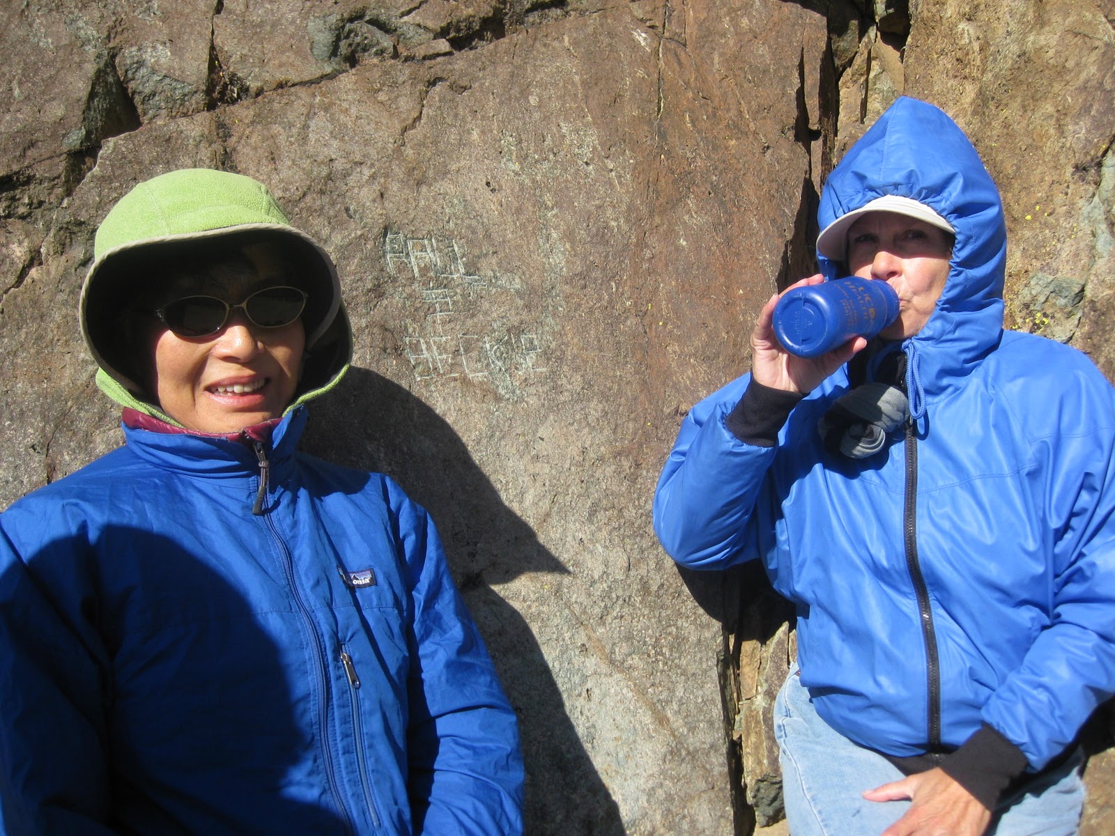
Heeding Dave’s emailed call for an 8:00 AM departure, five of us headed to Downieville and the trailhead above town. This involved driving through the very narrow (and fortunately deserted) back streets, up the Downie River. The road, now dirt, climbed away from the river and up to a saddle, called First Divide. Here we parked and began hiking the very well marked and maintained Second Divide trail. It was a chilly 36 degrees, but no wind and the steady climbing soon warmed us. The trail follows Pauley Creek, contouring along well above the water on the steep sides of the canyon. Rather soon we came to a side trail that plunged down to the creek and a cabin, the first of several we would see. It was a miner’s cabin, old but apparently snug and tight. It was boarded up for the winter and against marauding bears. I’m not sure how much gold is mined at this claim these days, but it appeared that good times were had aplenty.

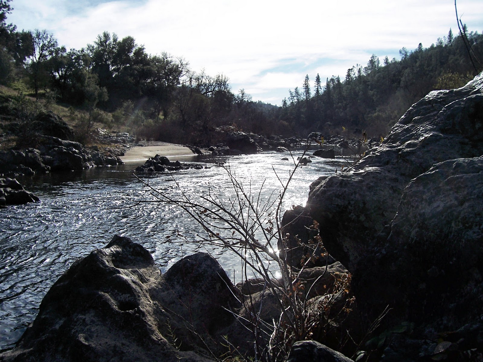
Back on the main trail, we continued on for several miles, marveling at rock outcroppings and some of the largest old growth Ponderosa Pines I’ve ever seen. This trail is absolutely beautiful and in such good shape that we could make pretty good time. We came upon another cabin and claim on a large glacial bench in a couple of miles. This was a larger cabin with a separate storage shed.

Continuing on, we eventually stopped for lunch on another claim site and cabin, the fanciest yet with separate equipment building with two motorized wheel barrow contraptions. We ate lunch below on the creek, all perched on a log above the water. Although it was only a little after noon, the mid November sun was low and the hiking heat dissipated quickly into the air and damp log. We ate and moved on, stiffened a bit and huffed and puffed up to the junction with the Third Divide trail. Here we turned back on the Third Divide trail and steadily descended, contouring down the steep sides of Lavezzola Creek, beyond earshot way below us. The forest here appeared dry, with very little underbrush and a lot of down trees. But once again, the trail was in perfect shape, with no trees blocking it. In fact, in places there was evidence of very recent trail work, preparing it for the winter, I suppose. This is the trail which is part of the Downieville Downhill, a famous (in mountain biking circles) trail which starts at Packer Saddle and drops 5000 feet in 17 miles. We saw not a single biker. In fact, we saw no other hikers all day.

The trail continues along the steep canyon slope for several miles, crossing a couple of springs and getting closer to the creek. We glimpsed another cabin across the water, and, in a rare opening in the forest across the creek, a ranch operation (which the map identified as Lavezzola Ranch). We finally crossed the creek on a beautiful steel bridge and reached the end of the trail at the county road. We would follow this back to our car, but first we admired the Empire Ranch, a beautiful spread complete with what appeared to be a helipad. No helicopter was seen, but the windsock made us think that the rock star or internet tycoon we figured must own the place used it to commute.

The last mile or two was easy road hiking, passing beautiful emerald pools and not seeing a single moving vehicle. All in all, a perfectly beautiful day in what was, for me, all new country.

10 miles, about 2500 feet of climbing.

No talk about next week’s hike, but many can’t make it due to T-day.
 I couldn't go on the hike so here is John's report.  Pix by Dave, map from Frank.


Thursday, November 3, 2011

Crooked Bypass

With a hint of rain in the air, fourteen of us decided to get one last hike in the high country.  The four vehicles headed up through the fall colors on the Carr/Feely Lakes Rd.  About halfway to the parking lot we were stopped dead in our tracks by a recently fallen pine blocking the road.  Since no one had a chainsaw handy, we waggled the branches and top, breaking off what we could.  Finally Clarence the Strong broke off the top enough to let the cars pass by. 

The trail was lovely and dry enough to the "big tree", Jim's landmark turnoff to Crooked Lakes.  We skittered on the edge of lakes and around trees and rocks, wending our way cross-country to the beautiful waterfall over the smooth brown rocks.  There we stopped for a leisurely lunch, enjoying the warm sun and rocks/listening to the water.  After lunch we walked around the next lake and continued XC to pick up the Grouse Ridge trail coming from Sawmill Lake.  We headed south on that trail and then turned right to go back down past Milk, Round, Long and Island Lakes.  We were surprised to see that on the outlet of the small lake past Island Lake, there appeared to be an island of leaves.  But they weren't leaves at all; they were parts of pinecones called bracts, floating in the water.  It took the work of countless squirrels over many summer days shucking cones to get at the seeds.  Truly impressive.   

That was a taxing 8 3/4 miles with a 1400 foot elevation gain.  The off trail portion was fun but tiring.

John and I won't be hiking next week as we'll be out of town. 
Clarence suggested the Hallelujah Trail off Hwy 20. It generally has a lovely showing of Dogwoods that are changing color. Meet at 9:00.


 Pictures by Maureen except the first one.


Thursday, October 27, 2011

Sierra Buttes

Although it was a crystal clear day, the thermometer hovered in the thirties as six of us stepped out of the cars for the shorter route we had all opted for.  Then it hit us:  a howling north wind with gusts strong enough to knock you off balance.  We donned as many garments as we had brought, some being more prepared than others and set off, heads down, coping.  The deafening noise combined with flapping nylon from hoods and other garments made for fast hiking to the base of the stairs.  Four of us made it up the stairs with pauses during the gusts to hold on to the cold railing and catch our breaths.  On top we found someone's waterbottle completely frozen, as we would be too if we lingered too long.  Huddling in the leeward side of the lookout, we laughed as we posed for pictures in the strongest blows which Dave estimated at 70 mph.  Going down the stairs was slightly more difficult as you couldn't lean over and the last flight of stairs nearly froze our faces off.  Our smarter compatriots were huddling in the lee of the cliffs as they waited.  Then we all quickly high-tailed it for the cars.  Too cold to stop for lunch.  We drove down to Sand Pond with it's windless, sun-drenched picnic tables and magnificent view of the Buttes. There was no sign of the windstorm from which we had emerged, unscathed but quite chilled.  After lunch we took a more leisurely stroll around the area on a boardwalk trail.  Craving hot soup, we stopped in Sierra City but our timing was off and the restaurant was closed.  The same was true in Downieville.  Oh well, home to HOT water, be it in a hot tub or shower.

The shorter route is about 4.5 miles RT with an elevation gain of 1600 feet.  We were all glad we had chosen this over the alternative longer route.  Enough is enough!


Sand Pond

Lower Sardine Lake


Depending on the weather, our group is considering one of the following hikes:  Pauley Creek near Downieville, or Island Lake counter-clockwise loop going cross country through the Crooked Lakes.  We will meet at 9.

The other group went to Malakoff Diggins.

Thursday, October 20, 2011

Out the PCT to Benson Hut and Maybert Rd.


Pictures by Maureen!


Seven of us braved the long trek of 12.5 milesRT with 2100 feet elevation gain to Benson Hut on the PCT.  Last year we measured the mileage at 11.5 and the year before at 12, so go figure.  It was exhausting as we were forced to go fairly fast by people's needs to be somewhere in the evening.  Two turned back just 1/2 hour short of the hut due to illness and a late afternoon commitment.  The trail was it's usual, spectacular self - incredible high views of various mountain ranges and valleys.  Large rocks jutted out of the windswept slopes with malakoff-like erosion and color.  It is a pleasure to go on a carefully constructed trail.  Yellow Aspens along 80 and on the beginnng area of the trail with red and yellow colored bushes made for some color. The sky was varying shades of blue with fluffy clouds, some containing a worrisome amount of moisture.   John discovered the trail behind the hut to the summit of Anderson Peak.  Next time we HAVE to do that.

It seems there was some confusion in the hike venues this time with some ending up unexpectedly at the wrong trailhead.  Be careful when loading your cars that the passengers want to stay out the same amount of time as you do.  Also it is important for the passengers to make their needs known.  This brings us to:


 NEXT WEEK:  Although this week's Maybert Road group decided to hike at 9, the group going higher decided on an 8 AM meeting.  This is because we plan to take the LONG ride to Sierra Buttes.  The group in our car will start at Packer Lake.  There may be other cars going to the higher trailhead further up the road.  Also, our car may NOT return to GV for  dinner.  The driving is all on paved roads.  Clarence thinks Sierra Buttes is a great idea and is planning on the 8 AM meeting time to do this hike INSTEAD of Malakoff Diggings.  When we have done this in the past we tend to meet up fairly near thelookout tower.   Maybe we will see Sand Hill Cranes flying low again!


From Clarence:

Our hike along Maybert Rd. at Washington started off with 5 of us. Then there were 9 of us. Finally there were 11 of us plus two friendly dogs. It was a typical unusual start! When we were all together we started off driving Maybert Rd. 3 miles to the Canyon Creek bridge. The road was in pretty rough shape. The Fall air was crisp and cool but it got plenty warm after a short distance hiking. We saw the same ole “dead cars” along the way. Just for good measure, someone had put many more bullet holes in them. Some of us even tried our hand at putting a couple more dents with rocks.
We came across the “Jolly Boys” mining claim and did a little more exploring and trespassing because no one was at home.
Finally we had lunch at the rivers edge. Some enjoyed the sun and some looked for shade before walking back toward Washington.

There was a suggestion to hike next week in Malakoff to see the fall colors, but also others that want to make the trip to the top of the Sierra Buttes, while it is still perfect weather. The trip to the lookout on the Buttes can be from two starting points. One from the Packer Lake area and an easier start on the PCT. ( I’ll take the easier one.) Because of the longer drive we would leave earlier, at 8:00 AM.

This group suggested to start our Wednesday hikes again at 9:00 AM. HOWEVER, not for this trip to the Sierra Buttes.  Those wanting to go to Malakoff can meet at 9:00.  At this time, there is no leader for that hike.


Pictures by Clarence.

Followers

Blog Archive