Four peaks - sore legs.
The 8:30 group did the first two (from Clarence): pix: Clarence and Maureen
Hope your group had a good day. The weather was wonderfully cool. We had 12 in our group, including a new hiker, Susan.
We drove up to Sugar Bowl area Jim suggested going to Donner Peak and Mount Judah. We got there pretty fast and we went to the great view of Donner Lake.
We then continued on to circle Mount Judah. We met a lot of other hikers (with dogs too) out on this midweek hike. We ran into a sizeable snow bank and a downed tree that we had get past. Very awkward and slippery! As you must have known, there was a crisp, cool, strong wind up there on top.
On the return section of the loop it was much easier and a welcome downhill.
Next week this group suggesting the trip to Mt Zion and Blue Lake. Looking for the petroglyphs at the end. Hope the weather is just as nice as today.
The 8 AM group did the second two:

Our group of 7 hiked 10.5 (9.5) miles (depends on which way you returned) and gained 2600 feet. Dave brought his friend, Lisa, who is a young and powerful hiker. Being from San Diego, she was excited about the flowers and SNOW. We ate lunch at the top of Castle Peak (for 4 of us it was the second time this year). View was great but hazy - Lassen just visible. We figured it was the smog of Burning Man. The wind was warm and comfortable. We walked along the knife edge, marveling at the low plants, especially buckwheats, paintbrushes, and Davis' Knotweed that can survive the severe weather. Mounds of locoweed pods were found in the lee of rocks and larger plants. Lisa started us amusing ourselves by throwing rocks on the steep snowbanks below us. They bounced all the way down making a satisfying clunk at the end. Finally Frank lifted a larger one for the throw. Darned if it worked too. We did worry that one of us would travel with the rocks, nominating us for a posthumus Darwin award.
 At the top of Basin Peak we found a new log-in book/geo cache in an ammunition box. We had remembered a different book. Finally Akiko realized she was looking at scraps of paper way under the rocks. After some sleuthing and reaching in the cracks we realized the old book had become a rodent nest. Luckily the rodent wasn't home.
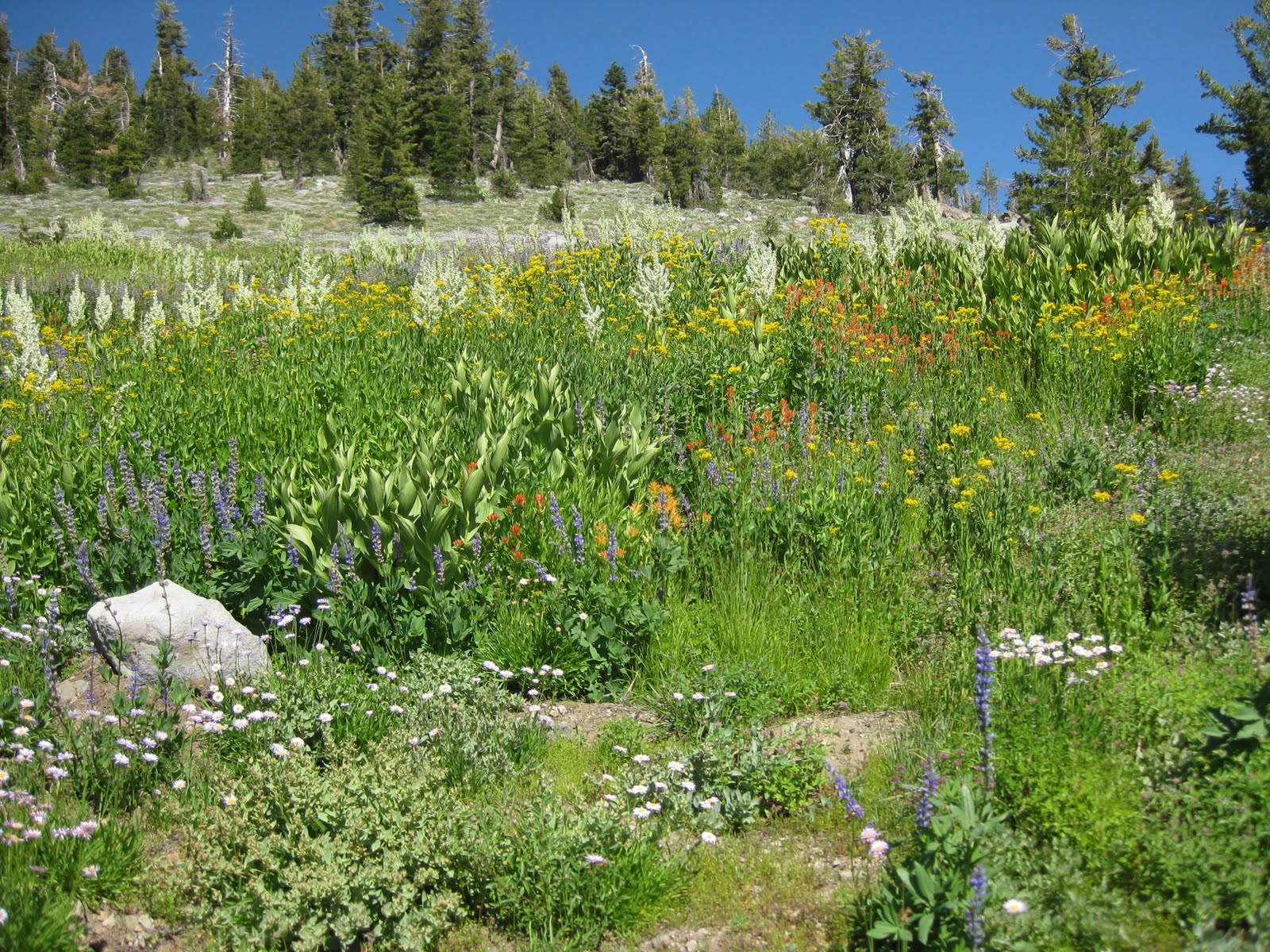
We descended the ridge/cross-countried to find that our favorite meadows were NOT as good as years gone by. Covered by snow and then ground not wet enough? They were good but not stupendous. Corn lilies, lupines, various yellow composites, stickseed, flax, paintbrushes, jacob's ladder, larkspur, and penstemon were dominant.

 Although we hadn't seen any other hikers all day, we did see 2 when we hit the PCT. One interesting and very large man with huge feet had been hiking since about 4/1 from Mexico. He purchases food in towns such as Truckee and mails some ahead to post offices. He said he only goes about 16 miles a day, taking his time talking to hikers and keenly observing his surroundings. All his clothes and head scarf were army green colored and his pack was not inordinantly large. Clipped to the front of his shirt was a solar cell for his phone and music. From his chest pocket he pulled a small and delicate journal with meticulous diminutive hand writing. It was interspersed with carefully and skillfully drawn illustrations of snakes, feathers, and the Peter Grubb Hut. This was his 4th volume. He planned to go to mid-Oregon and re-locate to Bend. All his belongs were on his back.
Next week: Extended hike and ride to Gold Lakes Basin. We will take a long hike but not nearly the elevation gain of this one. Dave is leading around Deer Lake. If you want to join us, come at 8 AM.
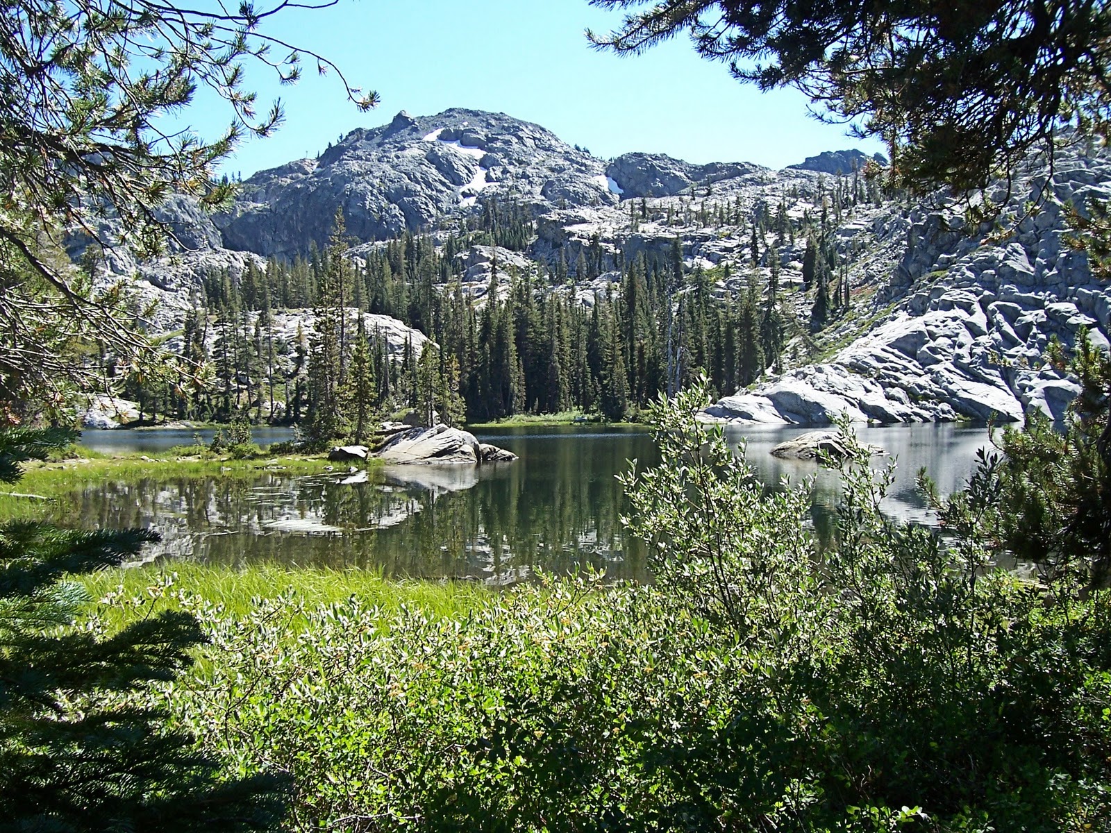
disappointing meadow
surprising tree we had missed on the way up but noticed going the other way


 Later we ascended some rocks for a different view and Akiko found some epidote on a piece of granite, a green crystal-laden face. On the way to Glacier Lake we took a "shortcut" up to the route we wanted. It was steep and difficult but this intrepid group was up to it. We rested and cooled our faces in Glacier Lake before the long trek (considering the late time) back down and then UP to the cars. Well, the hunters were right. The mosquitoes honed in on the group, trying mightily for a blood meal. Swatting and hiking fast, no one dared stop for a pee. We did not rid ourselves of them until we got above the trees at the cars.