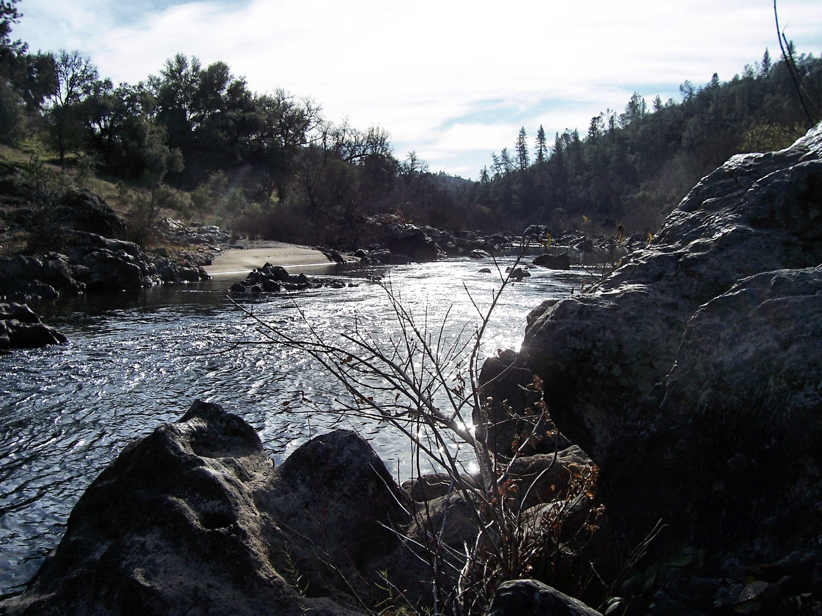
A ridiculously warm day in February - 16 of us hike at Purdon, up the trail towards Edwards. At the cut off to Round Mountain, half of us decided to go up the trail, and half decided to go further and then return to the river for lunch. Rendezvous would be on the Yuba at lunch time.
Error #1: No time was set for this rendezvous. This was compounded by the lower group not actually going much further and the upper group going too far in it's exploration, looking for the possible view out the other side.
When the upper group got to the well-marked trail to the lunch spot, they were dismayed to find that the lower group was leaving, feeling they had waited too long. The upper group needed to go there because they still hadn't had lunch.
Error #2: Carpools were divided up. Two people from the upper group decided to return with their carpool but Tiana was to go for a quick lunch, joining Rod and Susan later at the parking lot. The rest of the upper group was in one carpool.
Although wanting to leisurely enjoy her time by the river, Tiana hurriedly finished her lunch in order to not hold up her carpool. Although she worried about returning alone and being directionaly challenged, she dutifully repeated the directions to us and took off.
Error #3: No one went with a lone hiker.
Returning later to the parking lot the upper group of 5 was more than dismayed to find Rod, Ellen, and Rene still waiting on Tiana. It is fair to say that they were equally dismayed to see us and NOT Tiana. What to do? It was decided that John would take the upper trail and Peter would take the lower trail back about a mile to where the upper and lower join. This junction was the only one we could think of that may have confused Tiana UNLESS she went upstream to Edwards Crossing. The rest of us waited at the parking lot, snagging all the dog-walking hikers to look for a tall German white-haired hiker. By that time we feared she was hurt.
John and Peter returned exhausted and empty-handed. NOW what to do? Our cell phones didn't work at Purdon so, since we felt we might start losing daylight, we decided to drive to where they did work...one car would go to Edwards, the other to Sutton Way to see if her car was there. Perhaps she had gotten to Edwards and found a ride. The Sutton Way car would try to get ahold of the Edwards car and then we would call either 911, Search and Rescue, or the ranger we had met with a radio. Actually we were going to call him, anyway. Akiko and Elly would stay at the parking lot. After we two were loaded up with extra food and warm clothing, and cell phone numbers were exchanged, the rest of the people got into cars. IT WAS THEN THAT ROD FOUND A NOTE UNDER HIS WINDSHIELD WIPER.
Error #4: Check for notes??
Error #5: Leave more than one note!
How was it possible that Tiana had gotten to the parking lot BEFORE Rod and Susan and then decided to catch a ride with Priscilla?
Error #6: Repeat of Error #2.
So how WAS it possible? Tiana, with her long, strong legs; must have taken the upper route quickly back to the parking lot. Rod and Susan and Rene took the lower route and knowing they had to wait for Tiana, stopped to talk to someone and arrived at the parking lot slightly later.
Next week Clarence has mapped out a new hike in Spenceville. Those living closer to Spenceville can meet us at the regular Park and Ride or Hwy 20/Spenceville Rd. jct.
If anyone is interested, here is the link to Elly's 2012 calendar. It may be purchased directly from Lulu. http://www.lulu.com/content/legacy-lulustudio-calendar/my-calendar/12217884
Thursday, February 23, 2012
Thursday, February 16, 2012
Rice Crossing
Seeking a sunny locale to face the windy cold of a clear day, ten of us went 8+ miles down to Rice Crossing. Hiking back up, we took the side trail to Pt. Defiance for lunch at comfortable tables and "comfort stations". We kept up a brisk pace being urged along by a hyper Tiana, who had been hiking the day before at Empire Mine. We also kept up our usual brisk pace of conversations, covering the diverse topics of Ellen's mother, area history and it's ditches, what Elly does while John makes her lunch for the hike, computers, Maui, CPR, etc. After lunch we climbed the hill back to the cars. No discussion of next week...any ideas?
Wednesday, January 4, 2012
Spenceville Bunkers
Eighteen (!) hikers followed Clarence on a beautiful hike to the Spenceville bunkers. Were they for practice? Did they play war games between them?
The weather was unseasonably warm at almost 70, and although we thoroughly enjoyed it, we are concerned about the water supply.
Cows and even de-horned bulls frolicked in the fields while bellowing their annoyance at being disturbed.
The weather was unseasonably warm at almost 70, and although we thoroughly enjoyed it, we are concerned about the water supply.
Cows and even de-horned bulls frolicked in the fields while bellowing their annoyance at being disturbed.
![]() |
| son, not grand son... |
| Rod demonstrates the many uses of a rope as well as the difference between shadow and reflexion. |
Toward the end, we came across a dam which we thought might have been made by beavers. Then we came to our senses and realized the sticks had sawed, not gnawed, ends.
Saturday, December 24, 2011
Brr humbug...
from John:
We had a small group of six come out on the day of the winter solstice to hike the So. Yuba Trail upstream from the So. Yuba campground to Humbug Creek. It was chilly in the shade and warm in the sun and we hiked the beautiful trail at a nice brisk pace. The plan was to lunch at the picnic tables on the bluff where the creek hits the river. We got there in good time but found the whole area to be in the shadow of the immense cliff on the other side of the river. Both banks of the river were coated with white frost and sitting at the tables would have made for an uncomfortably cold lunch. So back we went to the spur trail which drops down to the big bend in the river, which we had seen on the way up to be drenched in sunlight. And so it was. We got back in time (barely) for Tiana to get ready for her latest Christmas party. She's been quite the party gal this season, so it seems.
No pictures this week. 8.5 miles.
No suggestions so far for next week (the 28th). Any ideas?
Thursday, December 8, 2011
Cronan Ranch
A cool day with high overcast - a long drive on highway 49 south of Auburn, just past the town of Cool is Pilot Hill - and thereby lies Cronan Ranch. It is a place of many trails so Frank mapped out a 6.5 mile loop that went down to the south fork of the American River and back. The hiking was hilly but not too steep, allowing us to zing right along although we stopped fairly often, once at a movie set for Love Comes Softly(?).
The return trail is notable for it's many green outhouses - possibly a take-out place for kayaks, large groups of them, or rafts.
Three guest hikers from other areas met us at the trailhead and hiked along with us. They were from Auburn and Rocklin.
Some talk of next week hiking Fairy Falls. We won't be able to make it due to a meeting regarding my mother.
All pictures by Maureen.
Thursday, December 1, 2011
Hidden Falls
Twelve of us hiked in balmy weather to complete the 5.5 mile Hidden Falls hike. The stunning ride to the park from Highway 49 was a bit foggy/misty but the ensuing winds blew away the clouds by the time we arrived.
Included here are 2 maps from Frank (plus the snake picture - the rest are by Maureen). One of the maps is of Cronan Ranch near Cool, where it is proposed we go next week.
Friday, November 18, 2011
Pauley Creek
Big Trees, Steep Canyons, Hidden Cabins
Hiking the Second Divide Trail out of Downieville
Heeding Dave’s emailed call for an 8:00 AM departure, five of us headed to Downieville and the trailhead above town. This involved driving through the very narrow (and fortunately deserted) back streets, up the Downie River. The road, now dirt, climbed away from the river and up to a saddle, called First Divide. Here we parked and began hiking the very well marked and maintained Second Divide trail. It was a chilly 36 degrees, but no wind and the steady climbing soon warmed us. The trail follows Pauley Creek, contouring along well above the water on the steep sides of the canyon. Rather soon we came to a side trail that plunged down to the creek and a cabin, the first of several we would see. It was a miner’s cabin, old but apparently snug and tight. It was boarded up for the winter and against marauding bears. I’m not sure how much gold is mined at this claim these days, but it appeared that good times were had aplenty.
Back on the main trail, we continued on for several miles, marveling at rock outcroppings and some of the largest old growth Ponderosa Pines I’ve ever seen. This trail is absolutely beautiful and in such good shape that we could make pretty good time. We came upon another cabin and claim on a large glacial bench in a couple of miles. This was a larger cabin with a separate storage shed.
Continuing on, we eventually stopped for lunch on another claim site and cabin, the fanciest yet with separate equipment building with two motorized wheel barrow contraptions. We ate lunch below on the creek, all perched on a log above the water. Although it was only a little after noon, the mid November sun was low and the hiking heat dissipated quickly into the air and damp log. We ate and moved on, stiffened a bit and huffed and puffed up to the junction with the Third Divide trail. Here we turned back on the Third Divide trail and steadily descended, contouring down the steep sides of Lavezzola Creek, beyond earshot way below us. The forest here appeared dry, with very little underbrush and a lot of down trees. But once again, the trail was in perfect shape, with no trees blocking it. In fact, in places there was evidence of very recent trail work, preparing it for the winter, I suppose. This is the trail which is part of the Downieville Downhill, a famous (in mountain biking circles) trail which starts at Packer Saddle and drops 5000 feet in 17 miles. We saw not a single biker. In fact, we saw no other hikers all day.
The trail continues along the steep canyon slope for several miles, crossing a couple of springs and getting closer to the creek. We glimpsed another cabin across the water, and, in a rare opening in the forest across the creek, a ranch operation (which the map identified as Lavezzola Ranch). We finally crossed the creek on a beautiful steel bridge and reached the end of the trail at the county road. We would follow this back to our car, but first we admired the Empire Ranch, a beautiful spread complete with what appeared to be a helipad. No helicopter was seen, but the windsock made us think that the rock star or internet tycoon we figured must own the place used it to commute.
The last mile or two was easy road hiking, passing beautiful emerald pools and not seeing a single moving vehicle. All in all, a perfectly beautiful day in what was, for me, all new country.
10 miles, about 2500 feet of climbing.
No talk about next week’s hike, but many can’t make it due to T-day.
I couldn't go on the hike so here is John's report. Pix by Dave, map from Frank.
Hiking the Second Divide Trail out of Downieville
Heeding Dave’s emailed call for an 8:00 AM departure, five of us headed to Downieville and the trailhead above town. This involved driving through the very narrow (and fortunately deserted) back streets, up the Downie River. The road, now dirt, climbed away from the river and up to a saddle, called First Divide. Here we parked and began hiking the very well marked and maintained Second Divide trail. It was a chilly 36 degrees, but no wind and the steady climbing soon warmed us. The trail follows Pauley Creek, contouring along well above the water on the steep sides of the canyon. Rather soon we came to a side trail that plunged down to the creek and a cabin, the first of several we would see. It was a miner’s cabin, old but apparently snug and tight. It was boarded up for the winter and against marauding bears. I’m not sure how much gold is mined at this claim these days, but it appeared that good times were had aplenty.
Back on the main trail, we continued on for several miles, marveling at rock outcroppings and some of the largest old growth Ponderosa Pines I’ve ever seen. This trail is absolutely beautiful and in such good shape that we could make pretty good time. We came upon another cabin and claim on a large glacial bench in a couple of miles. This was a larger cabin with a separate storage shed.
Continuing on, we eventually stopped for lunch on another claim site and cabin, the fanciest yet with separate equipment building with two motorized wheel barrow contraptions. We ate lunch below on the creek, all perched on a log above the water. Although it was only a little after noon, the mid November sun was low and the hiking heat dissipated quickly into the air and damp log. We ate and moved on, stiffened a bit and huffed and puffed up to the junction with the Third Divide trail. Here we turned back on the Third Divide trail and steadily descended, contouring down the steep sides of Lavezzola Creek, beyond earshot way below us. The forest here appeared dry, with very little underbrush and a lot of down trees. But once again, the trail was in perfect shape, with no trees blocking it. In fact, in places there was evidence of very recent trail work, preparing it for the winter, I suppose. This is the trail which is part of the Downieville Downhill, a famous (in mountain biking circles) trail which starts at Packer Saddle and drops 5000 feet in 17 miles. We saw not a single biker. In fact, we saw no other hikers all day.
The trail continues along the steep canyon slope for several miles, crossing a couple of springs and getting closer to the creek. We glimpsed another cabin across the water, and, in a rare opening in the forest across the creek, a ranch operation (which the map identified as Lavezzola Ranch). We finally crossed the creek on a beautiful steel bridge and reached the end of the trail at the county road. We would follow this back to our car, but first we admired the Empire Ranch, a beautiful spread complete with what appeared to be a helipad. No helicopter was seen, but the windsock made us think that the rock star or internet tycoon we figured must own the place used it to commute.
The last mile or two was easy road hiking, passing beautiful emerald pools and not seeing a single moving vehicle. All in all, a perfectly beautiful day in what was, for me, all new country.
10 miles, about 2500 feet of climbing.
No talk about next week’s hike, but many can’t make it due to T-day.
I couldn't go on the hike so here is John's report. Pix by Dave, map from Frank.
Subscribe to:
Posts (Atom)