Thursday, August 27, 2009

Sierra Buttes and Plantation Trail


Frank and Ellen drove Akiko, John, and me up to Packer Lake where we hiked up the fairly long, steep trail to the lookout tower. The weather was clear and pleasant: hot at the bottom, cool and windy at the top. As we neared the top, a truck load of French college students arrived at the 4WD parking area. They hopped out and loped up the mountain, full of the youthful energy we were lacking chatting with us going up and going down. One of the highlights, besides the tower stairs, rocks, and view was the sight of a couple climbing up a chute near us. We returned down the steep trails the same way we came up to avoid the road. My thighs are killing me but we won't go there. It's hard to return to high country from Bay Area sea level where we are trying to close out our apartment. Another highlight was a good old ice cream cone in Sierra City.

Next week: Penner Lake from Carr/Feely.

From Clarence:

Nice weather and a short drive from town we went to the side road off of Hwy 20. We walked on bike trails, foot trails and dirt roads to the reforested area of the Diamond Creek Plantation.
We never saw a bear this time, but we had another dusty trail walk. In the dust we saw MANY critter tracks, including bear tracks. They were probably running in the opposite direction from the noise we made.
A longer than usual lunch time, as we looked across the Bear Valley to the railroad and Hwy 80. We got a welcome nice cool breeze. 7 + miles but we were back to Glenbrook around 2:30.

Suggestions for the future sounded like the 8:00 group (but a scaled back version) to hike to the Peter Grub Hut ~ and to hike to the top of Sierra Buttes,(driving to the upper parking spot.) Good ideas for the fall season and before the snow flies.


Wednesday, August 19, 2009

Pioneer Trail


The smoke and the heat may have kept several people home today. Today our group was Selma, Cyndi, Marilyn S., me(Clarence) Stan, Jeff, Karen, Frank, and Laurie. We Followed the newly constructed section on the Pioneer trail south of the Omega Overlook. We only got started when Jeff heard and saw a bear. I got a glimpse of him, before the bear decided there was too many of us, and he ran off.
This new section of the trail is very nice. An area with beautiful large trees. However before we return we have to let the rains come and pack down the trail. For the most part it is a dirt trail, but right now it is all "fluff and dust" because it was just dug! Like walking in sand, it was not very easy.
I was surprised to find out when I took off my dusty boots, my socks were really dusty. I just threw them out! But when I took off my socks, my feet were black with dust also. Yuk! I guess everyone's feet were that way.
The trail will be extended even farther and with a BIG view of Bear Valley.
We need to put that on the agenda for a hike in a couple months (after the rains).

Farwell to Jeff for a while. He said his teaching job starts next week, so he won't be able to hike with us for a while. ~ Jeff, if you can,come with us on Christmas break or whenever.

Suggested hike for next Wednesday is out through Diamond Plantation, in the same region, to another BIG view for lunch.

See the other pictures, I took on Snapfish. See ya' all CLARENCE

Saturday, August 15, 2009

Lang Crossing to Lake Spaulding


Hi Group - while we were languishing with mosquitos in the woods and biting flies at the beach swamp (Chincoteague, VA) , you got to hike in the beautiful Sierra - so dry and relatively cool. We got some biking and swimming in - walking was not fast enough to escape the insects. We are now in DC for my niece's wedding and will be home soon. So the following is from Clarence:

Lang Crossing to Lake Spaulding was a scenic hike for eleven of us. The trail was a little rocky in some places, but a well travelled path. There were a lot of creeks to step across, but Jordan Creek (The main stream) has just about stopped moving because it is that time of the year!

One delay~ Tammy, Grace, and I were ahead of the rest. When the rest of the group hit a spur trial they didn't know which way we had gone, Wisely they stopped and had a snack! When we missed them, I returned to find them. We were then only 15 min to Spaulding and lunch.
Shade was a premium, but the view was generous. (See attached photos)

There was much more downhill going back, so it was faster. When we got near the parking we were also at the very inviting swimming hole. Karen insisted that she needed to get into that cool clear pool. So she twisted the arm of Tiana and they both swam off. The pool was very cool, but they found
a shallow rock basin, where the water was warmed from the sun. They loved it! Cyndi and I were content to just put our tired feet into the cool stream.

Next hike ~ Laurie has requested hiking along the Pioneer trail.

Friday, August 7, 2009

Two Groups, Two Peaks and Petroglyphs


Two Peaks


There were only 3 of us who climbed Castle and Basin Peaks, John and I and Akiko. We hiked a total of 9.5 miles with an elevation gain of over 3 thousand feet. Akiko and I, being so short, took it sufficiently slowly to not wear ourselves out. The clouds and wind were plentiful, keeping us quite cool and comfortable, if a bit windblown. After an odd (our realtor managed for get a hold of us) but spectacular lunch on top of Castle Peak, we hiked along a narrow ridge to Basin Peak at 9015 feet. This circumvented having that hairy Castle Peak descent with all that loose rock. We could see incredible views all directions as we made our way over rocks and around sheer drop-offs on the so-called trail. From Basin Peak we made our way down a sand/pebbly hill cross country to a trail that would take us down to the PCT. It traversed lush colorful meadows with the usual bushes, corn lily, paintbrush, monkey flowers, and fragrant pennyroyal but also at one wet area, that appeared to have a big stand of small white orchid on spikes. (I forgot to look it up and am on the road now.) We joined the PCT near the Peter Grubb Hut where we met a father and 11 year old son backpacking their last section to finish up a multi-year effort to hike the whole trail. After a second lunch at Castle Pass, we were ready to be finished and hustled the last two miles down the dirt road to the car.


From Frank:


5 1/2 miles hiking from beautiful Blue lake to the petroglyphs above Fordyce Creek and only a little more than 300 feet of climbing. Throw in nice cool weather, crystal clear views and it was a great day to be enjoying the high country. 11 of us (Clarence, Ellen, Frank, Karen, Laurie, Mary, Maureen, Priscilla, Selma, Stan and Tiana) all survived the roads up to Blue Lake and were treated to the views below.

(You will have to go to his website to see these -http://users.gotsky.com/fran )


All Blue Lake Photos by Clarence.


From Clarence:


No wonder they named it Blue Lake. It really lives up to it's name.

Frank and Ellen led the hike today for 11 of us. We all wanted to see the petroglyphs. They were the only ones of us that had seen them before. The unpaved road was rough, but also short. You could not ask for better weather.
As F & E promised the trail was EZ and scenic. Along the lake, then following an abandoned water ditch for most the way.The destination was a spectacular panoramic view, and of course the Indian markings. Plenty of petroglyphs.(See Photos) After the lunch and "photo op", we headed back. We stopped and snooped around someone's construction project, of a remote cabin on a hilltop. I'm jealous !
A good summary of the hike would be "Short and Sweet". We will go back again.

I have a suggestion for the 8:30 group next week. On Bowman Rd. Lang crossing @ the Yuba River, to Lake Spalding. Other ideas are welcome. See ya, C M


Tuesday, August 4, 2009

Moon Over the Mountains


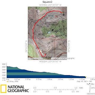
After fighting heavy 80 construction traffic, all three cars made the correct decision to use old 40 - which was lucky as there was no waiting for each other and only a slight delay as to which gondola time we would make. It was just as it was advertised: beautiful Squaw Valley (my first trip up there)...exciting ride up in the gondola and short (4 miles - steep at the end) hike a-top the ridge to Squaw Mountain. Fourteen hikers (both Mary's, both Barbara's, Akiko, Tiana, Frank and Ellen, Clarence, Maureen, Selma, John, Elly, and Cyndi joined us there) enjoyed the sunset and moon rise from this spectacular setting. The smooth gondola ride was spectacular! There was a slight forward sway at a couple of support towers but otherwise we glided effortlessly up the rock faces. Amazingly, the geology seems different from the usual gray and pink granite, tending towards the warm, more granular look of the southwest. Cold winds cooled us after the climb so we returned to a lower protected spot under a calving rock wall to eat "dinner" and watch the moon rise. On the way down, five of us dawdled to take pictures and enjoy the colors. The three chatting women realized they had taken the wrong trail when the men flashed their lights from across the ridge. Fearing missing the last gondola down, the women ran towards high camp in the waning light. We made it but further confusion ensued when we realized we couldn't find the group. After fruitlessly searching the restrooms, we found the group already on the gondola. Duh.

Tomorrow is Castle Peak for the extended hike - meeting at 8. Hope to see some hikers then. If no one is up for it, we will postpone that hike. The regular hike tomorrow is the petroglyphs above Blue Lake, Frank will lead.

Saturday, August 1, 2009

Donner Summit by John


We returned to the higher elevations again to find cooler weather and succeeded, in spades. Eighteen hikers rendezvoused at the Pacific Crest Trailhead on old Highway 40 at Donner Summit to hike to Donner Peak. It was a frustratingly slow drive up Hwy. 20 for three of the four cars which got caught behind a cement hauler going 20 MPH and blowing black smoke. We got underway at 10 and started the climb up the beautifully built, but rocky switchback trail. After several rests to regroup, we made it to the saddle between Donner Peak and Mt. Judah. While we were climbing, the sky was darkening, and the first rumbles of thunder were heard. Some decided that the saddle was enough of a hike, given the impending bad weather, and stopped there to eat. The rest scrambled up the short pitch to the top of Donner Peak, and enjoyed the view to the east and north, including the stunning Donner Lake right below us. We also watched a young couple doing some rock climbing on the vertical granite cliffs surrounding a beautiful rock amphitheater of sorts at the top of the mountain. The clouds continued to build, and we all decided to forget the idea of climbing Mt. Judah and instead to retreat to the cars. The first fat drops fell as we descended to the saddle, where we found that one of the carpool groups had already left. They probably avoided most of the rain and hail that the rest of us hiked through on the way down. We were all in cars and heading home when the real downpour let loose, flooding the road and calling for high speed wipers. We missed getting truly soaked by about five minutes! The temperature had dropped to about 60, but was in the low 90s when we got out of the cars back in GV.

Monday night, weather permitting, we meet at 3:30 PM for a 3:45 departure to Squaw Valley. Clarence will monitor the weather a best he can and email and call if he decides the weather is too iffy. Otherwise, see you Monday afternoon for the moonlight hike. Remember to bring warm clothes for the possible windy conditions at the top.

Next Wednesday the regular 8:30 hike will be lead by Frank and will go to Blue Lake and the petroglyphs that are above it. About a 6 mile roundtrip, I believe, with not a whole lot of climbing.

In addition, there will be a special hike leaving at 8:00 lead by John. We will go to Castle Peak, cross over to Basin Peak, descend to the PCT and return, via Peter Grubb Hut. Probably about 10 miles with about 2000 feet elevation gain, give or take.
Photos by Clarence.

Followers

Blog Archive