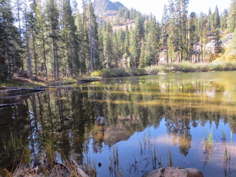
It was finally time to attempt Devil's Peak again. Five of us drove up and into Royal Gorge to the Devil's Outlook warming hut. Devil's Peak loomed in front of us as we emerged in the cool sunlight to begin the trek towards it. We knew from last year's experiences that we could not get up the gravel chute on the north side and that we would have to hike around to the SW side. We followed the trail across the dam and up a ways before heading west off trail, following a poorly ducked route in and out of some very large rock outcroppings. We came across a beautiful unnamed lake with a granite wall and talus forming its opposite shore.
 |
| Small lake |
Rounding the northern flank of the mountain, we went through an area of yellow-colored willows that we remembered from last year, and a forest that had been groomed to reduce its fuel load. Soon we hit the paved private road that comes in from Kingvale. When we got to the next warming hut we knew to turn left and head up to the south side on a road which ascended to the southern ridge of the mountain. We left the road to continue up the ridge in fairly open country and easy climbing. We encountered some faint trails and old roads which petered out as we headed due north along the ridge. The going got steep but not too difficult as we went around downed logs and such.
After a while, suddenly the peak appeared and was surprisingly close. Soon we got to talus and the footing was treacherous, requiring the use of all fours. At the end of the negotiable talus we were at the base of the columns that formed the peak. We headed around to the left, hugging the steep walls. In a short time we figured it was high time to sit and eat lunch. Some of us attempted to climb a few feet higher and sit in rock alcoves just big enough to wiggle your bottom in for a seat. It was no place for those with a fear of heights. The climb from here looked difficult and dangerous as it would be easy to either slip or dislodge a rock slide on your companions below. We'll leave further exploration to the younger generation.
 |
| From North (note chute) |
After lunch and some further exploration we cautiously headed back down the talus. Quickly, with Peter in the lead, he got into a yellow jacket nest and was stung as they defended it. The rest of us made the decision to bypass the exposed rock sheltering the nest and bushwhack down the talus that was covered with brush. Not very comfortable but it beat being stung.
We went back by Wagon Trail ski run but it quickly turned very unpleasant: hiking over river rocks. Those wagons must have shaken to bits. So once again we went off "trail" cross-country to the reservoirs below our car.
We had hiked only 8 miles with a 1300 foot elevation gain but were completely exhausted. Uneven footing and talus climbs are tedious and hard on the feet. We ate lunch 91 feet below the actual peak, which we will probably never set foot on.
We are still working on next week's hike. Possibly we will go to Beyer's Lake or check out the PCT off Highway 49 at Sierra City.
Driving home, we hit something on the road in Nevada City that is probably responsible for the complete tire destruction we experienced on Sutton. Lucky the tire held until then.
 |
| One of un-named lakes |
 |
| Okay - let's ride up this sucker... |
 |
| Base of pillars |
 |
| Lunch spot |
 |
| Good -bye mighty outcropping |
 |
| We have to climb what?? |
|
 |
| Doubt we will ever get to the tippy-top |


No comments:
Post a Comment