Thursday, July 19, 2012

Warren Lake Trail


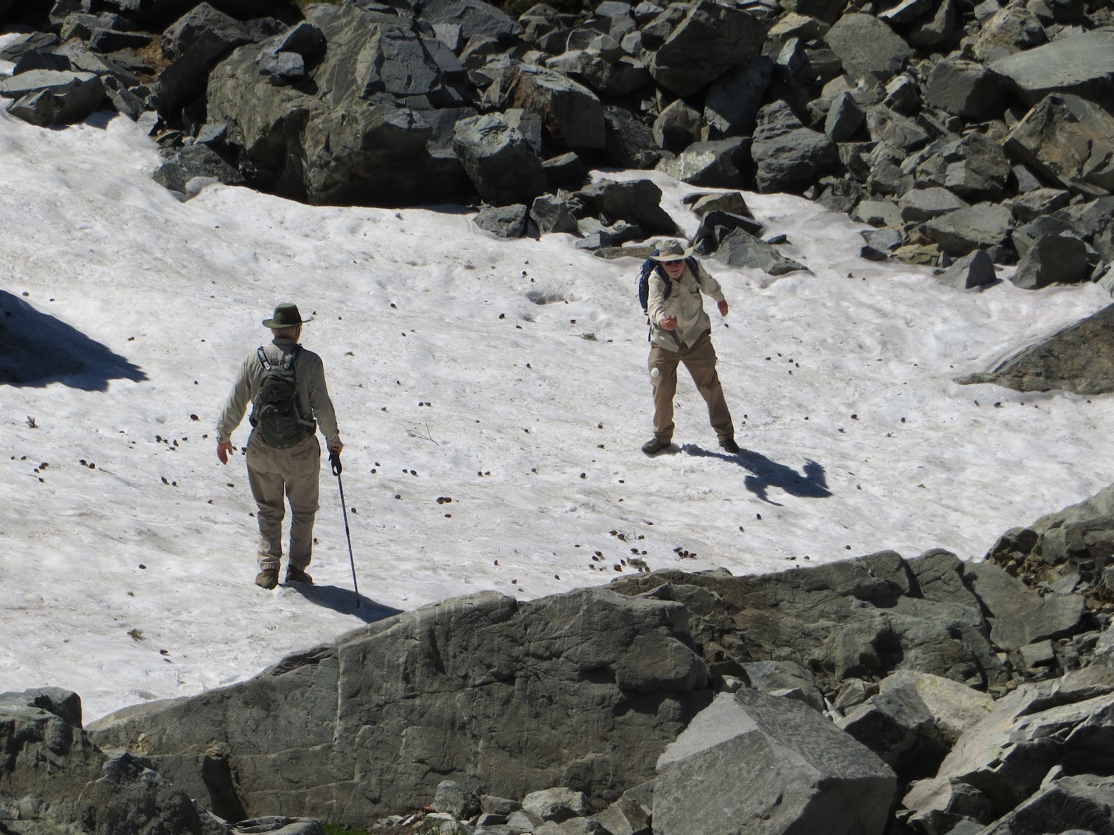
The eight o'clock group attracted six of us who headed up to the Warren Lake Trail for the most beautiful hike ever.  We parked on the north side of the Boreal exit, cross countried to the PCT, and headed east to the Warren Lake/Summit Lake junction.  Then we headed north, going through blooming meadows to the pass where we usually take the short lateral up to Frog Lake overlook.  The wind was blowing hard as we went over the pass and headed down towards Warren Lake.  The trail was steep in places but would level out through the meadows, past the snowbanks that were feeding the meadows.  We got to a ledge and decided to to have our lunch there.  The granite made comfortable seating as we could hang our legs over the edge straight down to an incredible valley.  We knew Warren Lake was out there somewhere but the view from this spot was spectacular:  Castle Peak to Basin and beyond...with it's cliffy drop offs into that valley.  We all agreed we could stay there forever...as the air was perfect, the sky perfectly blue with a few wisps of fast-moving clouds.  The wind was waving the willows and spirea down in the valley.  Hummingbirds were working the trees and penstemon on the cliffs. 
elephant heads

After lunch we couldn't resist the siren call of yet more meadow/flower viewing as we rounded the steep cirque towards the valley below.  We left the incredibly steep downhill trail several times - once to look at a humongous piece of lava rock, another to look at a rather large sun-bleached vertebrae, and a sign of man: a snow-mobile gas tank.  The rock overlooks all begged to be explored for further view as we looked up at the Basin Peak ridge overhead. Was this cirque an ancient volcanic crater?

 Down at the head of head of the valley, we ran across a lone hiker and his dog.  Although he was on a recreational hike, he was a member of the Truckee sheriff department and had been involved in a search and rescue operation in the area a few days before.  It made a great cautionary tale of a woman heading off too late in the day, alone, and with half-baked ideas.  We tax-payers pay for this sort of nonsense. 

We decided to turn around as we knew we had a very steep uphill to start our return hike and miles to go.  Way back at the confluence of the Warren Lake and PCT we met a Washington State couple reading books and waiting on the trail for their son, a thru-hiker.  They were picking him up to take him to their campsite at Donner Lake before he would continue north.  Apparently it is very hard for these thru-hikers to get enough calories so they had laid out an array of food for any hiker who passed.  Delicious oranges, drinks, candy, etc. graced the trail.  Other thru hikers came by - seems like a freeway compared to Warren Lake Trail, where we and that lone hiker were the only ones. 

We had hiked 9.3 miles with an elevation gain of 2400 feet.

Alarmed by the larger number in last week's later group, we did discuss liability.  Everyone needs to understand that they are on their own on these hikes.  Although we try to help each other, no one person or group is responsible for the inherent danger in mountain hiking. 

We are out of town next Wednesday, but others in our group are planning a hike at 8:00, details to come.

Flowers:

elephant's heads - 2 kinds
lupines - several kinds
mimulus - several kinds
paintbrush - several kinds
lilies: mariposa and alpine and corn
heather
penstemon - several kinds
coreopsis and mule's ears
columbine
cow parsnip
gilia - 2 kinds
checkerbloom


dragon of the landscape
On Wednesday at 9 a.m. Barbara Gable, Marilyn Shulman. and Selma Gregg drove to the PCT Trail Head. This time we turned left and took the trail under the freeway to Summit Lake. It was a little cool but warmed up hiking. Still lots of wildflowers including Mountain Aster, Indian Paintbrush, Mariposa Lily, Columbine, and many Fawn Lilies. It was delightful to sit in the sun at the lake and have a relaxing lunch. Many people where hiking the trail . Families with children and dogs ranging in size from small to large. The large dogs looked like white chow dogs. Maureen we forgot to ask the names to add to your dog list. We had a lovely day. Selma


Friday, July 13, 2012

Glacier Lake Plus

What with vacations and guests and such, only 3 of us turned out for the 8 AM hike.  With the heat beating down already, we decided to go high to somewhere where the water was, if we needed it.  Starting at Grouse Ridge we decided to go to Downey Lake and then cross-country to Glacier Lake trail trying to land somewhere near the confluence with the route up Sand Ridge.  Through the wonders of technology, we were only a few feet from the trail.  We had climbed boulders and avoided brush for the most part.  Then we headed up the sand ridge morraine among gardens of mule's ears, coreopsis, heather, delphinium, paintbrush, lilies, etc.  We were enchanted all the way and it continued at the top.  The air blew cool and we could see the view all the way to Lassen and the surrounding peaks.  At the top lake of the 5 Lake Basin group, we headed up to Glacier Lake.  There, we saw other people for the only time that day.  There were two groups of church youth campers. 

Black Buttes
Not content to call "uncle" we decided to explore after lunch.  We worked our way around the lake and up to the first snowfield.  Crossing below it, we climbed the talus and scree to a pass in the Black Buttes.  It was slow going but the outcroppings of brand new ferns and challenge of the climb made it lots of fun.  We were rewarded with the most stunning view from the top. 

Sierra Buttes
View from Black Buttes
As we worked our way down, we realized the kids had gotten out of the lake, were sliding on the big snowfields, and then they decided to also go up the peaks.  As we were walking out big rocks were tumbling down as the boys inadvertently loosened them in their descent.  Hope they all survived. 


View from Black Buttes


Glacier Lake down below
In a move not caught on video, I received a dunking in the first tarn we came across.  Attempting to wet my scarf to keep cool for the 2 hour walk back, I leaned out too far, doing a slow roll into the tarn.  Peter says my roll was slowed because my pack was partially opened, scooping up water as I went over.  Standing up in the tarn I could feel the water seeping over my boot tops.  We had to invert the pack to get most of the water out, squeeze out a few things, take apart the camera and cell phone, which amazingly still operate.  As I squished and dripped down the trail, I stayed cool. 

Once again the mosquitos were out in droves as  we wended our way through beer-ad meadows in the very late afternoon/evening light.  We had hiked 9.5 miles, not particularly speedily but some of it cross-country.


Full of mosquito repellent and sunscreen, we decided going all the way home instead of stopping at a restaurant was the best bet and even so, after cleaning up and doing chores, dinner was at 9.


 Since flowers seem to be in abundant supply, we are talking about doing the meadows on the side of Basin Peak - not decided yet about which route - possibly over Castle Peak shoulder to Basin or staying lower where those meadows are.  We will not be here the 25th, (Peter's 70th!!) but back the following week with more in mind: Lola?, PCT to Benson?, Frog Lake Overlook and beyond towards Warren Lake?, Blue Lake trail all the way to Bevis Lake (we looked down on it from Black Butte ridge)?, out to Sand Ridge Lake beyond Peter Grubb hut?  All these ideas are in the 9-12 mile range and are best with an early (8AM) start.  All those who are interested, meet us at 8AM next Wednesday.

Thursday, June 28, 2012

Loch Leven from the front door

Eleven of us met at the new 8:30 time and decided to climb the steep trail to the beautiful high lakes of Loch Leven.  The glaciated and morainal rocks gave way to the little creek crossing with its wildflowers and then up the the train crossing.  The remainder of the climb was mostly on switchbacks except for a few rough areas where fallen trees had blocked the way.  The many hikers had worn paths around them.  Lower LL was as beautiful as usual with mama birds leading their flocks here and there.  We ate lunch at Middle LL around on the beautiful rock towards the end.  This time we headed back to the point and had a little different view.  The weather was cool enough to sit in the sun or shade for a while.  Below us the irridescent blue dragon flies were both emerging from their exoskeletons and mating/depositing eggs on various surrounding plant life. 

We were happy to see red columbine, mariposa lilies, and the phlox, wallflowers, and penstemon, paintbrush, lupine that we expect in the high country. 


Next week is July 4th and at present no hike is planned due to the holiday.  The following week there is is one idea but we can be flexible:  Frog Lake Overlook...8:30 group...

From Selma:

The 9 a.m. HIking group consisting of Karen, Priscilla, and Selma drove to the PCT Trailhead on I-80. We hiked to Angela, Flora, And Azalea Lakes. We practically had the place to ourselves. Met and talked with a hiker who had started in Mexico and was headed north. Saw several people on the opposite side of the lake swimming. More varieties of wildflowers than we have seen the last few weeks. At the junction of the PCT Trail the meadow was filled with "Shooting Stars". Also saw lots of red Penstemon growing around the rocks. Not as many Phlox as last week. Other flowers we found were Delphinium, Indian Paint Brush, Lupine, Mountain Aster, and Mountain Azalea. Sorry no pictures. Karen was happy to soak her feet in the cool water of the lake at lunchtime. It was a very pleasant day. No delays on the roads due to construction or traffic in either direction.

Selma

Thursday, June 21, 2012

Penner Lake

A far cry from a year ago, the Island Lake area was not ice and snow; the mosquitos were in heaven and campers abounded.  Our large group split the first time at a Crooked Lake, with four having to return earlier than others.  The rest of us went on to Penner where we dominated the camping (far) end dawdling over lunch in the perfect mountain air.  As some dipped their feet in the cool water, a swimmng snake came to investigate.  Becoming bored, he "s-ed" is way down to the mud and swam to deeper waters. 

On the way back we divided and reunited a few times, finally leaving one carpool to return a tad earlier than the others.  Two carpools went out on Island Lake's rock penninsula to take in the view and put feet in the water once again. 

Although there were campers around at both lakes, we pretty much had the silence of the areas to ourselves.  We saw another swarm of bees as well as some wildflowers:  Mountain Jewel, Wallflower, Penstemon, floresent-looking Phlox, and meadows of Pussy Paws. 

We returned rather late but did get to enjoy the place we had driven so far to hike in.  Not everyone wants to take that luxury of time.  Choose your carpools carefully. 

On our drive home, we almost hit a coyote as he decided to bound across Brunswick between Peter's and our cars.

Photos by Maureen.


We hiked 7.3 miles with an 1100 foot elevation gain.  Next week we will leave Sutton Way at 8:30 for a high country hike.  It sounds like there may be an alternative group that leaves at 9 for a shorter hike. 

Friday, June 15, 2012

Bowman Mtn. Loop

first pictures by Maureen...


 Thirteen of us hiked the Bowman Mountain loop on a warm but not too hot day.  This time we did NOT go cross-country to find the path and we maintained an even pace to the lake overlook, the cute little tarn, and watch tree.  We saw camas lilies (purple AND white) when we crossed Loney meadow and glacier lilies where snow had melted.  We reached the tarn late enough to eat lunch there which brings up the subject of whether we should now start the hikes at 8:30.  I will email you separately on this.

We decided to head down the path to Lower Rock Lake, skipping the Upper lake as we had just done it recently.  We saw the usual pussy paws in the burnt out area but no columbine yet.  I also saw a plant I tentatively identified as Western Waterleaf...related to Caterpillar Phacelia. 

Later, attracted by relentless  buzzing we realized we were watching a swarm of bees that was relocating from the home nest.  Some of us got out binoulars and cameras to get a closer look.  Fascinating behavior. 

We had hiked 8 miles with a elevation gain of about 1300 feet.


From map down from Frank.


Thursday, June 7, 2012

Poorman's Creek South Yuba


Thirteen (?) of us started at Poorman's Creek in Washington to hike along the S. Yuba.  It seemed lighter and brighter than usual and the green-colored river was flowing quite rapidly in spots.  The single track rocky trail provided a few wildflowers, Sticky Chinese Houses - a member of the monkey flower family, Sticky Monkey flower, CA mildweed, pine drops, and redbud trees with lovely, burgundy seed pods.  Our picnic spot on the Yuba was spacious and comfortable.  Several members took their shoes off and dipped their feet.   Clarence's neighbor, Jayne, shared her beautiful, creative cards that she makes with pressed flowers and ants.    She uses a variety of presses to create her designs and then laminates them onto the card.  Clarence panned for gold and came up with a few flakes before we left.

  After much confusion about extending the hike, only our carpool decided to go further to the Logan Canyon bridge.   The weather was cool enough to make good time but Selma set an awfully fast pace.

Besides Jayne two other new faces were my friend, Terry, from Chicago Park; and her friend Ingrid, from Colfax. Ingrid is training for a Yosemite hike between Sierra Huts.
 

Next week - a few suggestions have been put forth: Fordyce Falls, Bowman Mountain, Loch Leven from "back door", and Bear Valley.  We would like to see wild flowers.

Followers

Blog Archive