Wednesday, June 8, 2011

Stevens from Iowa Hill, a guided trail


Five of us took off to Iowa Hill Road on the other side of Colfax. Although twisty, it was paved and well engineered. Only a little carsick, we pulled up in front of the Iowa Hill store, which actually was a bar. The porch held several tatooed, pierced beer drinking types, having their smokes and brews. As we alighted from the car, we were greeted by a crowd of dogs and informed that one of them would be our hike leader. Shorty was the meanest looking hombre in the pack but indicated he would be quite happy to lead us to the American River. No fee. So I will let him tell the tale (pun intended).

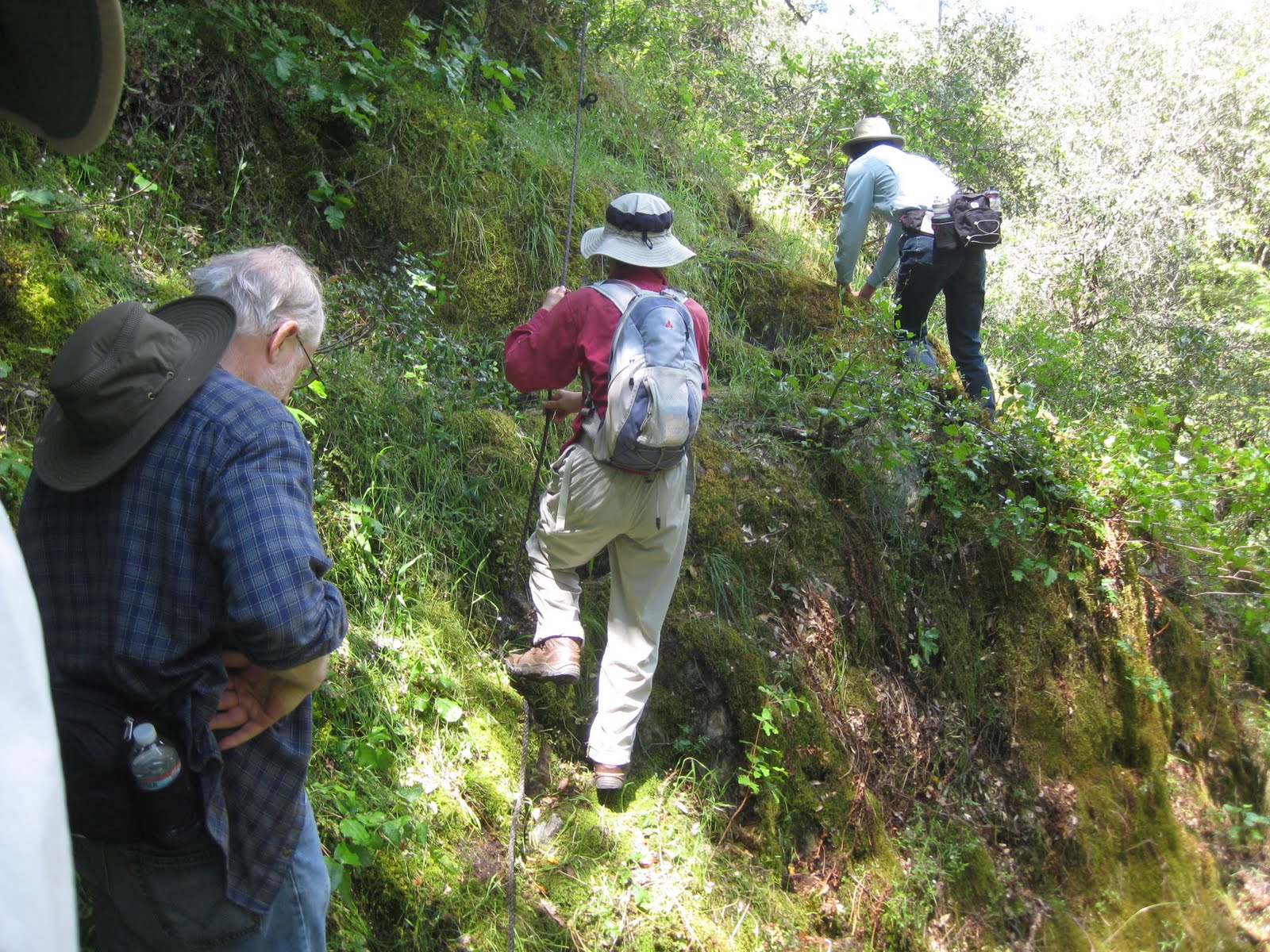
Shorty, here...led my small group down the steep hill. They were mighty slow as they slid down one of the many trails to the main one. I whiled away my time by criss-crossing the trails and always returning to lead them down the main one. The group kept stalling at the wildflowers and the Hawaiin Grotto but they managed to continue following me down the beautifully built (at one time) trail. Admittedly there were sections where one false step could pitch them down the hill but what's a little poison oak? And they were SOOO slow when they had to cross slippery rock or logs and especially where they had to use a previously installed rope to go over one section. What wimps. After 3.7 miles they stopped by the river for lunch while I drank heartily. With my refined manners I didn't even eat the large crumbs these humans dropped until they were picked up and hand fed.

After a while we started back up the trail but when the humans got separated from each other, I got a little confused and tried to warn the 3 in the back of danger up ahead. I kept stopping which they didn't like as they nudged me along, reassuring me that these humans were not dangerous. About 25 minutes from home, I could hear the generators humming, keeping the electricity on for the houses and allowing people to watch daytime TV. I smelled the kibble waiting, and figuring the humans knew the way back, took off for home.

If you plan to take this trail: POISON OAK can't be avoided - it is 7.4 miles RT with an elevation loss and then gain of 1650 feet. Phew. But I, Shorty, would be happy to be your guide.

Incredibly beautiful wildflowers:

Coral Bells
Indian Pinks
Paintbrush
Fairy Lanterns
Nemohulus
Milkweed
Larkspur
Wild Rose
Showy Monkeyflower
Penstemon
Mallow
Iris
False Solomon's Seal
Blue Dicks
Wild Onion
Star Flower
Madia (yellow)
Cat's Ears
Thimbleberry
Clarence is talking about the dogwoods near rte 20 for next week and/or explore the new Hirschfield trail on Cement Hill.

Wednesday, June 1, 2011

Empire Mine


Despite the hazardous weather outlook, 5 of us gathered for a local short walk before the 11 AM prediction of weather mayhem. We chose the part of the mine on the north side of Hwy 174, starting in the "mines" neighborhood off Gold and Silver Way (behind Goomba's). Wending our way through the alleys of oak and pine, on fairly wide paths, we met a good number of similarly-minded walkers. Cat's Ears, Ceonothuses ,irises, a creeping sage, starflowers, checkerbloom (?), asters, pretty face, and CA lilac were all in bloom. Scotch broom was also in bloom which should remind us all to do what we can to pull it out. I also saw a spotted tohee and a flicker.
As we neared the end of the loop, we decided that since it was 10:50 and there was still no sign of serious rain, we would do the loop through the main section of the park. I felt we were assured no rain as John and I had donned our rainpants and raincoats. As we started on that trail, the clock turned 11 and the sky burst forth with hail. This time there was no hesitating: we turned around and high-tailed it to the car. No more hiking in cold wet weather for us. Since it was late morning, four of us decided to go for soup at Briarpatch.

Wednesday, May 25, 2011

Deer Creek


Five of us plus 2 fur hikers idiotically braved the weather report and set out to follow the new Land Trust access trail for Deer Creek. The trail started in Pioneer Park, Nevada City - wound around and through NC, crossing Broad St. twice until it got serious and followed the road past Miner's Foundry and along Deer Creek. Many interesting creekside homes can be seen on this route which finally headed down through a series of switchbacks to the creek, itself, which was raging towards itsWildwood and Engelbright destinations. We saw members of the Land Trust moving dirt around, packing the trail and getting it ready for the Saturday opening. Some clever half-log benches were scattered along the trail, as well as at least one small bridge across a gap. At one point we took a detour to Stocking Flat. The well-engineered trail switch-backed down to a newly restored area with a lovely bridge that unfortunately was blocked off at it's end due to that part of the trail not being developed yet. The denuded (thanks to the miners) vegetation near the river's edge was being restored with natives and a retaining wall partially built with petrified wood. Since we could go no further, we returned to the trail which continued along an NID ditch. After a while a familiar white truck passed on a road up the hill. Hmmm, we wondered...could it be? A few minutes later the truck appeared on it's return and stopped! Clarence! We invited him to join us but he demurred, inviting us to return in his truck.
Well, we should have. At the end of the trail, the first drops appeared. The winds picked up, the temperature dropped, and the rain diddled around until it poured in cold hard drops. No shelter for lunch so we just high-tailed it back...sopping and sloshing...longing for some hot soup but too wet to go sit in a restaurant. We dripped into Frank's car, raincoats (for what they were worth by that time), and dog fur, all glomming together.
Sometimes you just don 't win the bet with mother nature.
Note: Tiana, ever the exercise enthusiast, had a bike accident on the Pioneer Trail. When she hit a root, the fall resulted in the handle bars hitting and fracturing her sternum. Ouch. She is taking it easy for a while. We wish her a speedy recovery.

Wednesday, May 18, 2011

Wolfe Rd.


Just three of us gathered at the meeting area - the rest of you were worried about rain! Akiko, John, and I decided that the possible impending rain meant we should walk in the open, without mud and slippery rocks. So we were surprised that a sign at the beginning of Wolfe road actually warned that hikers might be on the road. So, except for the traffic, we enjoyed the wide open views, clouds and wildflowers that adorned the road. We identified iris, arnica (or whatever those are), paintbrush, lupine, clover, sage, fairy lanterns, brodiaea, cat's ears, and lots of yellow flowers, all in the asteracea family - particularly one called Madia.
We ate at the house foundation that used to have an easy chair sitting in the middle. The views were dramatic and through it flew a large flock of good-sized birds - looked like Tundra Swans but I doubt they really were. The scary part was that they were flying South!! Do they know something we don't know??
After 8 miles, almost back to the car, a small, white SUV slowed down and there were Frank and
Ellen! They were tired of being housebound and decided to get out and do a bit of geo-cacheing...so we stopped and talked a while. Small world.

Saturday, May 14, 2011

Spenceville new area


I’m sending these pictures in a different way this time. Hope this works for you. (Feedback ?? )

Karen K. drove from Yuba City and met us at Spenceville for a new hike on the “Lookout trail.” There was seven of us.
The blue sky opened up and we hiked past the Lower Wood Duck Pond. We could not get across some wet areas, but hiked out and around to head up to one of the highest hills in the Spenceville area. We had a wide spectacular panoramic view as we had lunch.
The hills were lush green and there were still MANY wildflowers. It is probably the last chance for a hike in Spenceville as the weather can get very hot there.
For next Wednesday, The hike from Purdon crossing toward Edwards was requested and recommended.
Pictures by Maureen.


Friday, May 13, 2011

S. Yuba/Missouri Bar to Washington


Due to catastrophic failure of the blog website, my entire post from Wednesday has been lost in the ether. Needless to say I am annoyed and frustrated. So here goes an abbreviated form of the post:
Six of us drove 2 cars to Washington, avoiding the early morning drunks adorning the road, a beer can between them. We parked one of the cars and all piled into the other one for the Relief Hill backroad trip (actually the road was recently scraped and quite good) to Missouri Bar trailhead. The trails were quite good, relatively easy for the amount of up and down switchbacks, so the 10 miles flew by.
Wildflowers adorned the trail with a few new ones for this season: scarlet fritillary, pine drops, showy phlox, orange wallflowers, an arrow-leafed mules ear type flower - arnica?, purple nightshade, and a low-growing ceanothus grew by the parking area. Otherwise there were large trillium and buttercups, larkspur, stickseed, bleeding heart, monkey flowers, and redbud in abundance.
The river was green in the calmer areas and white and blue in the rapids. The streams raced down to the rivers over a myriad of falls, some with plants growing through the water. Lunch was by the river but the only visitors we got were ants, spiders, and ticks. Not the glamour of last week's bear.

Followers

Blog Archive